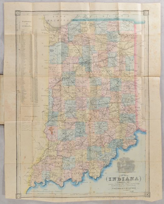
"A New Map of Indiana Exhibiting the Counties, Townships, Cities, Villages, and Post Offices Rail Roads, Canals, and Common Roads", Mendenhall, Edward
Subject: Indiana
Period: 1866 (dated)
Publication:
Color: Hand Color
Size:
14.1 x 19.5 inches
35.8 x 49.5 cm
This attractive, uncommon map of the state shows counties, roads, railroads, canals, and post offices. The National Road is prominently shown crossing through the middle of the state from Richmond to Indianapolis and Terre Haute. A population table to the left of the map shows strong growth from 1850 to 1860 with total population increasing by 36% over this period. A vignette of the capitol building appears above the title. Surrounded by a decorative border. Folds into brown cloth-covered boards with gilt tile on front cover (3.7 x 5.3").
References:
Condition: B
Issued folding with contemporary color. There are a few small stains, short splits along the folds, and light scattered foxing, much of it confined to the margins. A 1" tear appears in the border at left where the map is attached to covers. Covers are lightly sunned with minor wear.