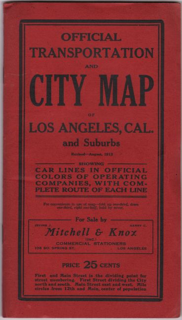
"Official Transportation and City Map of Los Angeles California and Suburbs...",
Subject: Los Angeles, California
Period: 1913 (dated)
Publication:
Color: Printed Color
Size:
31.5 x 44.1 inches
80 x 112 cm
This large-scale map was published by Laura Whitlock, one of the few female mapmakers in the United States at the time. It shows the extensive rail lines in operation at the time and uses color to distinguish the lines of Los Angeles Railway, the Pacific Electric Railway, and the Glendale & Eagle Rock Railway. The branch lines are also located and named: Sawtelle, Venice, Santa Monica, Whittier, Covina, Pasadena, and Glendale, to mention a few. The map extends from Griffith Park in the north, Vermont Heights in the south, Inglewood to the west, and South Pasadena in the east. Griffith Park shows no development. Folds into printed red covers (5" x 8") with 12-page street index. On the inside wrapper is a listing of all stations and stops for the Los Angeles Railway Company. A full-page advertisement for the Pacific Electric Railway appears on the back wrapper. This example appears to be the fourth edition of Whitlock's map, with copyrights for previous editions dating from 1910. We have seen subsequent editions dating as late as 1924.
Whitlock's maps were frequently copied on the market, but she was very diligent in litigating to protect her copyright. In fact, one of Whitlock's maps was involved in the first conviction for copyright infringement in the United States. Click here for a newspaper story from the June 11, 1913 issue of the Los Angeles Herald detailing the conviction.
References:
Condition: A
On a bright sheet, issued folding, with a couple tiny splits at fold intersections and minor extraneous creasing. Covers are very good, with slightly bumped corners.