Catalog Archive
Auction 194, Lot 192

"Johnson's Nebraska Dakota, Colorado Idaho & Kansas", Johnson and Ward
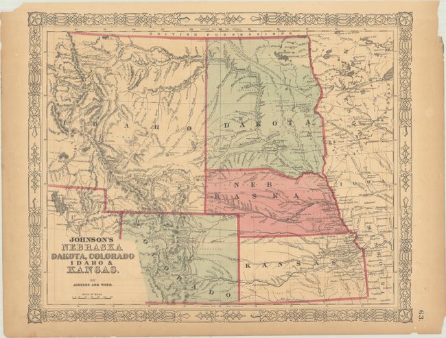
Subject: Central United States

Period: 1864 (circa)

Publication: Johnson's New Illustrated (Steel Plate) Family Atlas

Color: Hand Color

Size:
15.8 x 12.8 inches
40.1 x 32.5 cm
Download High Resolution Image
(or just click on image to launch the Zoom viewer)

Handsome map that depicts Dakota Territory and most of the huge Idaho Territory that existed prior to the creation of Montana and Wyoming. Explorer routes, wagon roads, army forts, and the proposed routes for the Pacific Railroads are all identified. There is good detail of topography and watersheds. Surrounded by a decorative metalwork border.

References:

Condition: B+

There is light toning, minor offsetting, a couple of edge chips, and several short edge tears that have been closed on verso with archival tape.

Estimate: $110 - $140

Sold for: $80

Closed on 9/13/2023

Archived