Catalog Archive
Auction 194, Lot 184

"Map of the Southern and Border States, Showing the Actual Positions of the National and Rebel Forces, and of the Blockading Fleets and Vessels...", Colton, George Woolworth

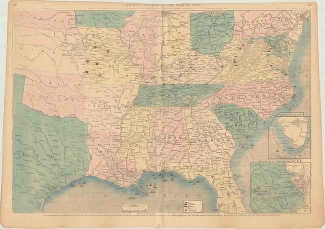
Subject: Southern United States, Civil War

Period: 1861 (dated)

Publication: Pictorial History of the American Civil War

Color: Hand Color

Size:
29.7 x 20.2 inches
75.4 x 51.3 cm
Download High Resolution Image
(or just click on image to launch the Zoom viewer)

A large and detailed map of the Southern and border states showing the actual positions of Union and Rebel forces, blockading fleets and vessels, the positions of the various fortifications, and the localities of important battles. Features two insets at lower right including "Vicinity of Washington City D.C." and "The Southern Portion of Florida." Drawn on wood and issued in Frank Leslie's Pictorial History of the American Civil War.

References:

Condition: B+

There is light scattered foxing and minor creasing. Top margin is partially trimmed with text still visible.

Estimate: $140 - $170

Sold for: $110

Closed on 9/13/2023

Archived