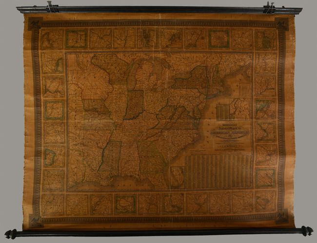
"Mitchell's National Map of the American Republic or United States of North America. Together with Maps of the Vicinities of Thirty-Two of the Principal Cities and Towns in the Union", Mitchell/Young
Subject: Eastern United States
Period: 1844 (dated)
Publication:
Color: Hand Color
Size:
47 x 38 inches
119.4 x 96.5 cm
This is a very nice wall map that was drawn by J.H. Young and engraved by J.H. Brightly. It extends into the eastern part of the Independent Republic of Texas and the large Indian Territory. On this early edition, Minnesota is not named. West of Wisconsin is the huge Iowa Territory, which is filled with Indian tribes including the Dacotah, Sioux, and Pottawatomies. Within the map is an inset, Map of the North-Eastern Boundary of the United States According to the Treaty of 1842, which details the Webster-Ashburton Treaty, and another smaller inset Map of the Southern Part of Florida, which shows no settlements of any kind south of Fort Jupiter. The map is very detailed with hundreds of place names, roads, villages, railroads, ports, etc. A table gives the 1840 population for 120 cities and another gives the states' population of Whites, Free Blacks, and Slaves. The state of New Hampshire is listed with just one slave and 537 Free Blacks. Surrounding the map are 32 city plans which are contained with a wide decorative border. This large wall map should not be confused with the smaller (24 x 34") and more common map with the same title. Backed in linen with original rollers.
References:
Condition: B
Contemporary color with moderate, even toning, scattered spots, and some light cracking. Ribbon edging is no longer intact. Original rollers are still securely attached.