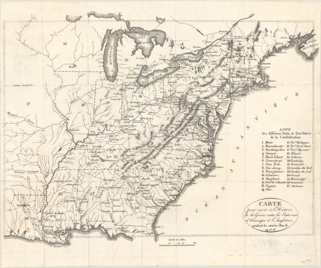
"Carte pour Servir a l'Histoire de la Guerre Entre les Etats-Unis d'Amerique et l'Angleterre, Pendant les Annees 1812, 13, 14 et 15",
Subject: Eastern United States
Period: 1820 (circa)
Publication:
Color: Black & White
Size:
13.1 x 9.9 inches
33.3 x 25.1 cm
This map served as the frontispiece to the French edition of Henry Brackenridge's History of the Late War, between the United States and Great-Britain. The map covers the region from the Eastern seaboard to well past the Mississippi River and Louisiana. 27 states and territories are keyed to the map including the large Northwest and Missouri territories where the land is noted as contree unexploree (unexplored country). East of the Mississippi, the transportation network is the focal point where wagon roads, trails and the river systems are prominently depicted.
References: Phillips (Maps) p. 877; Howes #B-684; Sabin #7164.
Condition: A
Issued folding and now flat with a couple of small paper flaws. A binding trim at bottom right has been replaced with old paper.