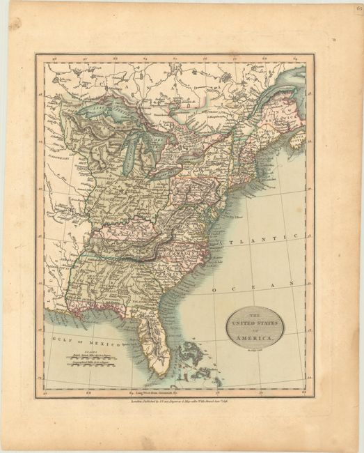
"The United States of America", Cary, John
Subject: Eastern United States
Period: 1816 (dated)
Publication:
Color: Hand Color
Size:
9.2 x 11.2 inches
23.4 x 28.4 cm
A handsome map covering the country from the Atlantic Ocean westward to just beyond the Mississippi River. A large Louisiana Territory that extends north to Canada borders The Western Territory, which is comprised of today's Minnesota, Wisconsin, Illinois, Indiana, Ohio and Michigan. Florida is divided into the Spanish possessions of East and West Florida. The map is filled with place names, forts, Indian villages, roads and more. A pair of distance scales and a simple, oval title cartouche decorate the map.
References:
Condition: B+
There are a couple of small spots in the image and a light dampstain in the lower right corner that is confined to the blank margin.