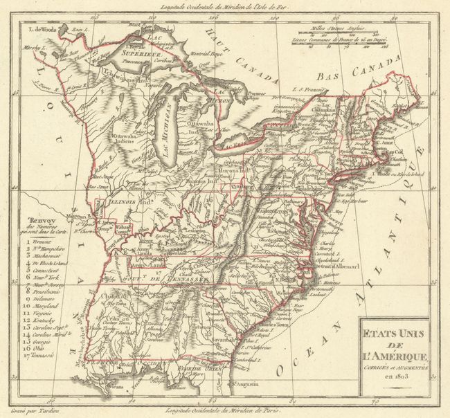
"Etats Unis de l'Amerique, Corriges et Augmentes en 1803", Tardieu
Subject: Eastern United States
Period: 1803 (dated)
Publication:
Color: Hand Color
Size:
7.9 x 7.2 inches
20.1 x 18.3 cm
Nice view of the early United States with its western boundary on the Mississippi River and seventeen states listed. Includes a large unnamed Northwest Territory that extends to the Mississippi and Ohio Rivers and includes Illinois. Ohio, which had just been admitted as a state the year this map was published, is shown in a very early, truncated configuration. Everything west of the Mississippi is named as Louisiane. Good detail throughout including locating the several Army lands (Wabash, Illinois, Ohio, and New Jersey Companies) and numerous native tribes.
References:
Condition: A
Contemporary outline color on a sheet with very wide margins and minor soiling.