"[Lot of 2] Plan of the Route of the Northern Pacific Railroad [in] Charter of the Northern Pacific Railroad Co... [and] Profile Shewing the General Features of the Route of the Proposed Railroad to the Pacific...",
Subject: Northern United States
Period: 1853-65 (dated)
Publication:
Color: Black & White
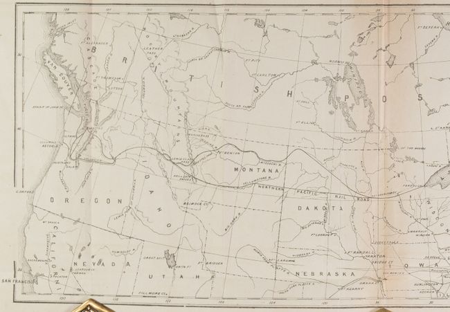
A. Plan of the Route of the Northern Pacific Railroad [in] Charter of the Northern Pacific Railroad Co..., by Alfred Mudge & Son, published 1865 (22.9 x 8.2"). This map shows the course of the proposed Northern Pacific Railroad, extending from the Great Lakes to Puget Sound. The final route travels though central Dakota Territory and southern Montana and marked "Northern Pacific Rail Road," while Governor Stevens' route is also depicted to its north, eventually meeting up again at Lewis & Clark Pass and on to Puget Sound. The map is still bound to the front of the 62-page charter, which includes the Act of 1864 granting land for the railroad (40 million acres!), details on its organization and principals, and the railroad's advantages and benefits. Condition: The map is mostly clean and bright with some extraneous creasing and minor toning along one fold. Disbound text is clean and bright. (B+)
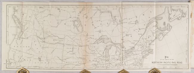
B. Profile Shewing the General Features of the Route of the Proposed Railroad to the Pacific, from Chicago, Ill., to the Straits of Juan de Fuca via the Valley of the Upper Missouri..., by E.F. Johnson, dated 1853 (33.6 x 7.0"). An early profile of the route issued 12 years prior by Edwin Johnson, who would become Engineer-in-Chief of the construction of the Northern Pacific Railroad. Condition: There is extraneous creasing, minor foxing, and a small chip at lower left. (B)
References:
Condition:
See description above.