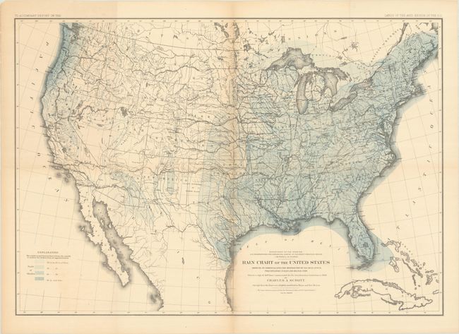
"Rain Chart of the United States Showing by Isohyetal Lines the Distribution of the Mean Annual Precipitation in Rain and Melted Snow", Powell, John Wesley
Subject: United States
Period: 1878 (circa)
Publication: Lands of the Arid Regions
Color: Printed Color
Size:
28.4 x 19.9 inches
72.1 x 50.5 cm
This thematic map is a copy of the chart constructed for the Smithsonian Institution in 1868 by Charles A. Schottt. Wheat says "that such maps could now be constructed demonstrates the quantity of observational data American scientists had amassed, as well as the effective aid maps could render in the presentation of such data." Legend shows via pattern and color different annual rain falls. From Powell's report that describes the limits of the lands in the arid regions of the West. Lithographed by the firm of Julius Bien.
References: Wheat (TMW) #1290; Rumsey #2347.
Condition: B+
Issued folding with a hint of toning along the fold lines and a short fold separation that has been closed on verso with archival tape.