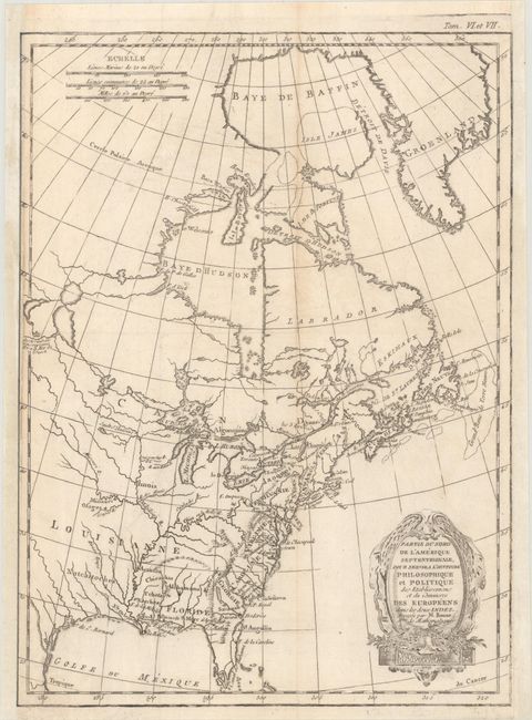
"Partie du Nord de l'Amerique Septentrionale, pour Servir a l'Histoire Philosophique et Politique des Etablissemens et du Commerce des Europeens dans les Deux Indes", Bonne, Rigobert
Subject: Colonial Eastern United States & Canada
Period: 1774 (circa)
Publication: Raynal's Histoire Philosophique et Politique
Color: Black & White
Size:
9.3 x 12.7 inches
23.6 x 32.3 cm
This attractive map of the eastern part of North America shows the British colonies confined along the eastern seaboard with French Louisianne and Canada taking up the interior. In the upper left is a series of rivers and lakes purportedly connecting Hudson Bay with la Mer de l'Ouest (Sea of the West). Features include the notation of the Natchitoches tribe in Louisiana Territory, along with numerous additional native tribes. Three distance scales and a fine shield-style cartouche embellish the composition. There is no engraver's imprint on this edition.
References: McCorkle #774.1.
Condition: B+
Issued folding, now flat, on watermarked paper with light toning along the vertical fold. Both sides have been professionally remargined, with most of the border drawn in facsimile.