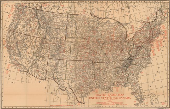
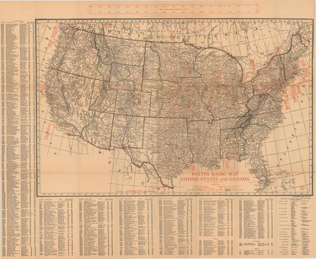
"Poates Radio Map of United States and Canada",
Subject: United States & Southern Canada
Period: 1924 (dated)
Publication:
Color: Printed Color
Size:
29.8 x 19.3 inches
75.7 x 49 cm
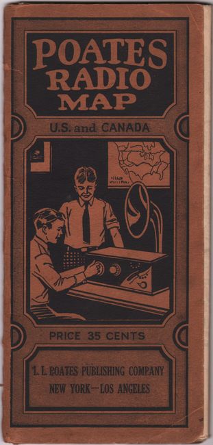
This early radio map was published by L.L. Poates and was designed to assist in locating radio (AM) stations across the United States and southern Canada. The map is divided into eight non-sequential "Radio Districts" with small red dots identifying broadcasting stations. At left and bottom is an extensive list of nearly 1,000 radio stations with the call sign, frequency and location of each. Above the map is a distance scale functioning as a "distance finder by inserting pin in hole at either end on home station." Folds into pictorial paper covers (4.5 x 9.5").
References:
Condition: B+
Issued folding with some light toning and several small splits at the fold junctions. Paper wrappers have light wear and some separations along the spine.