Complete Edition of Anson's Voyage
"A Voyage Round the World, in the Years MDCCXL, I, II, III, IV...", Anson, George
Subject: Exploration & Surveys
Period: 1756 (published)
Publication:
Color: Black & White
Size:
9.5 x 11.6 inches
24.1 x 29.5 cm
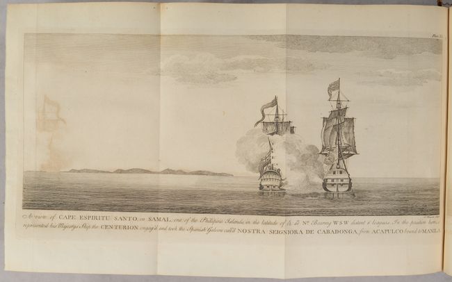
This is the ninth edition of Anson's work describing his voyage around the world. In 1740, George Anson set sail in command of a squadron sent to attack Spanish possessions and interests in South America. The expedition was ill-equipped and failed to carry out its original ambitious mission. By June 1741 when Anson reached Juan Fernandes, his force had been reduced to only three of the original six ships, while the strength of his crews had fallen from 961 to 335. After launching several attacks on the west coast of South America and recuperating on the island he collected the remaining survivors on his flagship, the Centurion, and set sail in search of one of the richly laden galleons that conducted trade between Mexico and the Philippines. The indomitable perseverance he had shown during one of the most arduous voyages in the history of sea adventure gained the reward of the capture of an immensely rich prize, the Nuestra Señora de Covadonga, which he encountered off Cape Espiritu Santo on June 20, 1743. From here he sailed back to Canton before traveling through Southeast Asia and around the southern tip of Africa. He made his way back to England, arriving in Spithead in June 1744.
This quarto version is complete with 43 plates (42 plates plus a frontispiece chart of the world), including all maps and charts depicting his voyage. Of particular interest are the following folding maps engraved by Richard Seale:
A Chart, Shewing the Track of the Centurion Round the World (15.9 x 9.0”). This chart delineates Anson's world circumnavigation, one of the last great buccaneering voyages. Details in the chart are limited to the immediate region affected by the voyage leaving continental interiors blank save for large rivers, lakes, and seas and important cities. California is depicted as an island, a very late depiction of this cartographic error. Condition: There is some foxing and offsetting. (B)
A Chart of the Southern Part of South America... (18.4 x 20"). This handsome chart shows the route of Capt. George Anson's expedition from St. Catherine's Island off the coast of Brazil, around Cape Horn and up to Juan Fernandes Island (now known as Robinson Crusoe Island) off the coast of Chili. The chart shows numerous calculations of water depth, ocean currents, and includes navigational notes. A decorative compass rose with fleur-de-lys is positioned in the sea. Condition: There is faint offsetting and a repaired 1.5” binding tear at left. Some minor edge tears and chips are confined to the left side margin. (B+)
A Chart of the Channel in the Phillippine Islands… (21.1 x 27.5”). Anson's chart of the Philippine Islands spans from Luzon to Leyte. The focus of the chart is on the track of the Manila Galleon from the Mole of Cabite until it is clear of land, north of Samal. Decorated by rhumb lines and a large compass rose. Condition: There is offsetting, some extraneous creases, and a short fold separation along the left sheet edge. (B)
A Chart of the Pacific Ocean from the Equinoctial to the Latitude of 39 ½d. No. (33.5 x 10.7"). This unusual chart joined on two sheets details the route of Spanish galleons between the Philippines and Acapulco. The tracks of British Navy Commodore George Anson and Spanish Nostra Seigniora de Cabadonga are shown. A somewhat speculative depiction of the islands of Japan is shown at top left. Condition: There is some foxing and offsetting. (B)
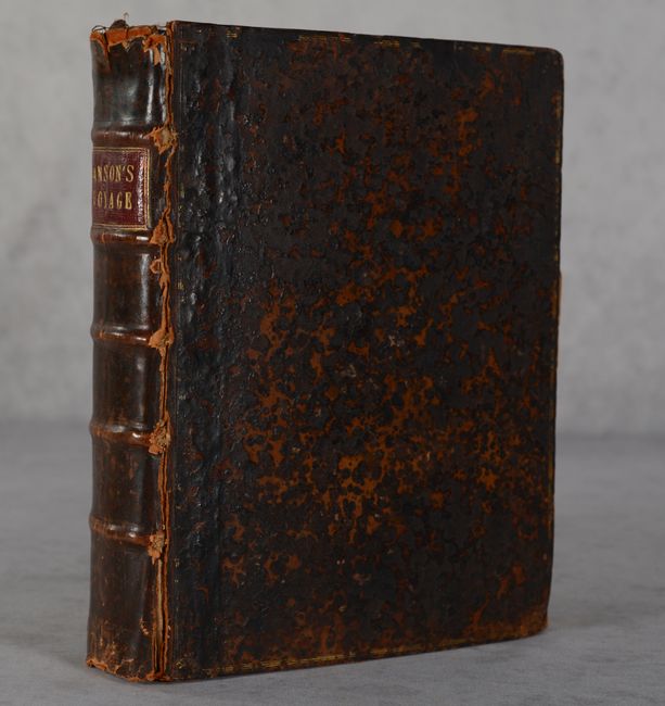
The remaining plates include coastal views, naval battles, land views, and an interesting plate depicting a pair of sea lions. Title, dedication, contents, introduction, 417 pages of text, and directions to the binder. Hardbound in full contemporary leather with raised bands and title label on spine.
References: cf. Shirley (BL Atlases) G.ANS-1a; Mercator's World Nov/Dec 1998 pp. 45-51.
Condition:
See description above for the four folding maps. The other plates are very good to near fine with light offsetting. Text is mostly clean with occasional offsetting. There is a bookplate for the Heytesbury House on the front pastedown. Hinges are starting. Covers are heavily scuffed and worn. Folding Maps/Binding (B), Other Plates/Text (B+)