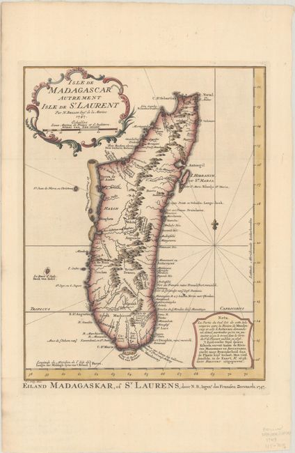
"Isle de Madagascar Autrement Isle de St. Laurent", Bellin/Van Schley
Subject: Madagascar
Period: 1747 (dated)
Publication: Histoire Generale des Voyages
Color: Hand Color
Size:
8.8 x 11.4 inches
22.4 x 29 cm
This is an uncommon Dutch edition of Bellin's map of Madagascar, with good detail of the mountainous topography, rivers, sand bars, and harbors. The note at bottom right explains that the southeastern portion of the island, between the Antavare and Mandreray Rivers, requires a level of detail that could not be included on this map, but is available on a map by Sr. de Flecourt published in 1656. The title is encased in a rococo cartouche, and an alternate Dutch title appears below the map: "Eiland Madagaskar, of St. Laurens, door N.B., Ingen.r des Franssen Zeevaards, 1747." Engraved by Van Schley.
References:
Condition: A
Issued folding on a clean sheet of watermarked paper. There is some archival reinforcement along the upper fold on verso.