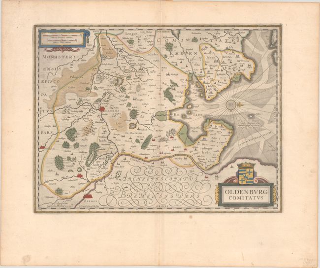
"Oldenburg Comitatus", Blaeu, Willem
Subject: Northern Germany
Period: 1659 (circa)
Publication:
Color: Hand Color
Size:
19.5 x 14.8 inches
49.5 x 37.6 cm
This highly decorative and very attractive map of the vicinity of Oldenburg and Bremen shows the Jadebusen and the estuary of the Weser. The topography and towns are beautifully detailed with nice representations of the forests and river system. The map is oriented with north to the right by a nice compass rose. The map was beautifully engraved by Everard Simonsz Hamersveldt, who worked for all the important cartographic publishers of the period including Hondius, Jansson, Blaeu and Speed. Spanish text on verso, published between 1659-72.
References: Van der Krogt (Vol. I) #2320:2.2.
Condition: A
A dark impression with full contemporary color on a wide-margined sheet with a large watermark of the god Atlas. There are a couple of unobtrusive spots of foxing in the map, and minor abrasions on the centerfold and in the scale of miles cartouche.