"Atlas National Illustre des 89 Departements et des Possessions de la France Divise par Arrondissements, Cantons et Communes...", Levasseur, Victor
Subject: France, Atlases
Period: 1869 (published)
Publication:
Color: Hand Color
Size:
14.9 x 20.6 inches
37.8 x 52.3 cm
Victor Levasseur's "Atlas National Illustre" and "Atlas Universel Illustre" are among the last decorative atlases published. The maps are all lavishly illustrated with scenes of the countryside, products and activities indigenous to the region.
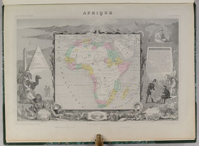
This was one of the last decorative atlases ever produced. The finely engraved title page, which sets the stage for the beautiful maps to follow, is made up of several vignettes depicting famous land and sea battles, a portrait of Napoleon I, cherubs practicing the arts and sciences, and more. In addition to the maps of the 89 individual French departments, the atlas contains maps of the world, continents, Oceania, and French colonies for a total of 102 maps. The map of North America shows the United States extending into Canada in the Pacific Northwest, despite the fact that the Oregon Boundary Dispute had been settled decades earlier. France was an ally to the U.S. and supported their position in the Fifty-four Forty or Fight dispute. The North America map is surrounded by beautifully engraved scenes of North and Central America including local animals, a ship stranded in the polar sea, and a Mayan temple. This fine and complete atlas is filled with maps that have lovely decorated borders that relate to the region, including statistical information, regional products, famous local people, indigenous animals, and places of interest.
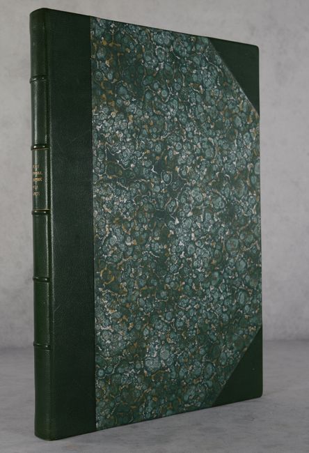
Handsomely rebound in quarter green leather over green marbled paper-covered boards with raised bands and gilt title on spine, and new endpapers.
References:
Condition: A
Nearly all of the maps have excellent impressions with occasional minor marginal soiling or foxing. The first two maps (Ain and Aisne) are in good (B) condition with moderate soiling and an edge tear on the map of Ain. The map of Ain has trimmed margins and has been pasted on to the map of Aisne, obscuring the left-hand side of Aisne. The title page is lightly soiled with a small chip at bottom. The new covers and spine are in excellent condition with a few minor scuffs.