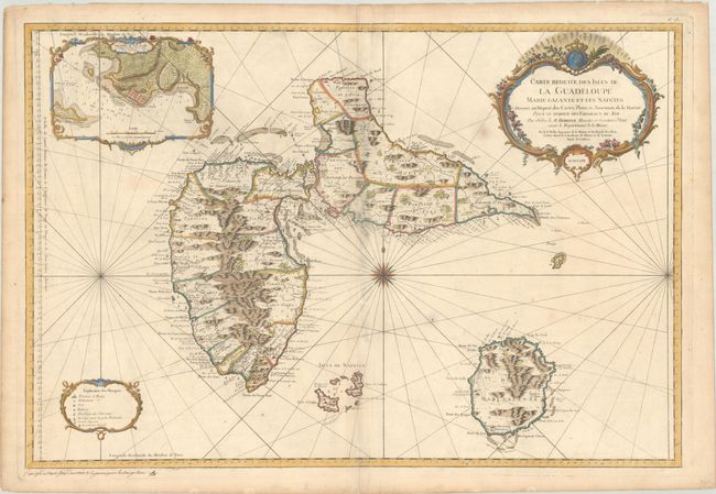
"Carte Reduite des Isles de la Guadeloupe Marie Galante et les Saintes Dressee au Depost des Cartes Plans et Journaux de la Marine...", Bellin, Jacques Nicolas
Subject: Guadeloupe
Period: 1759 (dated)
Publication: Hydrographie Francoise
Color: Hand Color
Size:
34 x 23.1 inches
86.4 x 58.7 cm
Superb large-scale sea chart with great detail of parishes, forts, towns, settlements, anchorages and topography. Includes Les Saints and Marie Galante. The large inset shows the environs of Fort Louis surrounded in a delicately engraved border. The chart is centered with a large compass rose with radiating rhumb lines and ornamented with title and distance scale cartouches. The meticulous topographical and nautical detail makes this one of the major 18th century maps of Guadeloupe.
References: Phillips (Atlases) #590; Sellers & Van Ee #2010.
Condition: B+
A crisp impression on a sturdy sheet with a large eagle large watermark. There is light soiling that is more prominent along the centerfold, a few small spots, and some abrasions also along the centerfold with partial loss of a few place names.