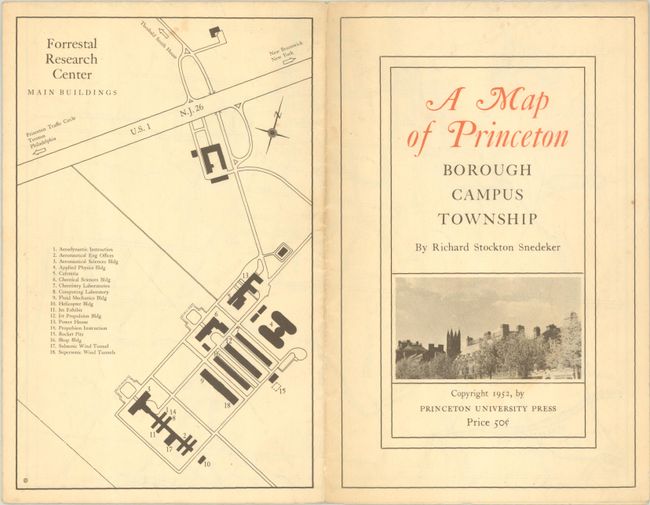
"A Map of Princeton Borough - Campus - Township",
Subject: Princeton, New Jersey
Period: 1952 (dated)
Publication:
Color: Printed Color
Size:
16.6 x 10.6 inches
42.2 x 26.9 cm
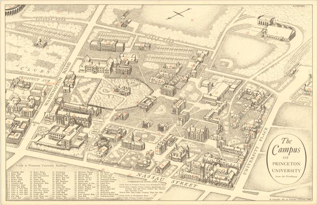
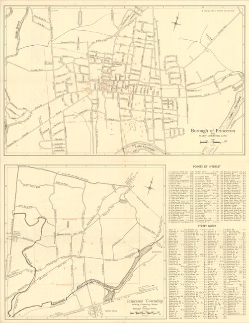
This self-folding pamphlet was created by Richard Stockton Snedeker and published by Princeton University. It includes a bird's-eye view of the campus, street maps of the borough and township of Princeton, and a map of the buildings within the Forrestal Research Center (now known as the Princeton Forrestal Center). Numbered keys are included with each map to identify buildings and important locations with the numbers printed in red on the maps. The pamphlet also includes a bit of history of the town of Princeton and the university, noting the student population at 3,500. The lovely bird's-eye view depicts the campus from the northwest with the buildings drawn in three-dimensional perspective, with stippling used to illustrate the surrounding grassy quads and forested areas.
References:
Condition: A
The maps are generally clean and bright. There is light wear along the folds and a couple of tiny holes at fold intersections. The map of Forrestal Research Center, which serves as the back cover, and the front cover of the pamphlet are both lightly toned and soiled.