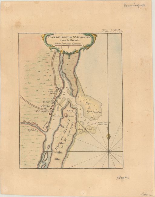
"Plan du Port de St. Augustin dans la Floride", Bellin, Jacques Nicolas
Subject: St. Augustine, Florida
Period: 1764 (circa)
Publication:
Color: Hand Color
Size:
6.3 x 8.2 inches
16 x 20.8 cm
The fortifications of St. Augustine are illustrated on this map with good information on the soundings in the entrance to the harbor. St. Augustine is the oldest European city in the United States. Juan Menendez de Aviles established the first settlement nearly a half century before the first English settlers landed at Jamestown. St. Augustine grew to become the Spanish center of power in North America for almost 200 years. The British gained control of the city in 1763 at about the time of this map's publication. Rhumb lines and a fleur-de-lys orient the map in the blank sea.
References:
Condition: B+
A nice impression on a lightly toned sheet with minor foxing and soiling. There are a few extraneous creases along the edges of the sheet, and a tiny tear at right has been closed on verso with paper tape.