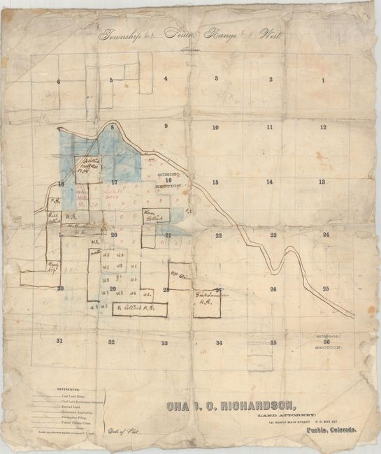
"Township 21 South. Range 61 West",
Subject: Pueblo County, Colorado
Period: 1880 (circa)
Publication:
Color: Hand Color
Size:
12.3 x 15 inches
31.2 x 38.1 cm
This manuscript map depicts a portion of Pueblo County and was drawn on top of a partially printed skeleton sectional map published by “Chas C. Richardson, Land Attorney, Pueblo” and printed by the “Chieftain Print” with imprint at top (established in Pueblo in 1868). Not dated, but the map is circa 1880 or earlier with most of the sections still vacant U.S. lands. A river (likely the Arkansas River) is shown in manuscript flowing through the township with land south of the river showing some subdivisions and named property owners, including many members of the Collins family. Charles C. Richardson was an attorney, rancher and Pueblo County historian. This is a good example of a township development plan in progress.
References:
Condition: C+
A working example that was backed with linen and folded. There are areas of loss along the fold lines, most notably at center and top center. The map is separating from the linen at bottom and the edges of the sheet are chipped and tattered.