"Yosemite National Park Motorists Guide", U.S. Department of Interior
Subject: Yosemite, California
Period: 1934 (dated)
Publication:
Color: Printed Color
Size:
24.1 x 34.3 inches
61.2 x 87.1 cm
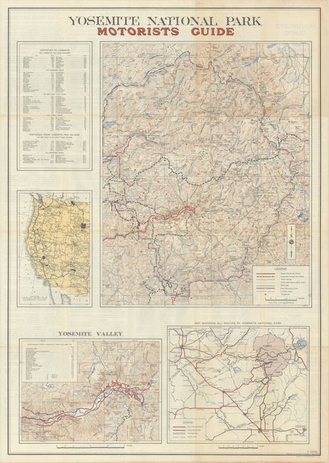
This government-issued guide contains 4 maps on one sheet for exploring Yosemite by automobile. The large map presents the entire park and identifies 66 miles of paved roads in red, 142 miles of "improved" roads with dashed line, and other roads in outline. Legend also notes 648 miles of trails, railroads, and about two dozen telephones sprinkled throughout the park. Inset maps show detail on driving in the Yosemite Valley, a regional map of central California, and a map showing national parks in the western United States. Related text on verso. Self-folding.
References:
Condition: A
Issued folding on a bright sheet with a hint of toning where the map self-folds into brochure format.