"[2 Maps with Report] Geologic Map of the Navajo Country Arizona, New Mexico, and Utah [and] Map of the Navajo Country Arizona, New Mexico, and Utah [with] Geology of the Navajo Country...", U.S. Geological Survey (USGS)
Subject: Arizona, New Mexico & Utah
Period: 1917 (published)
Publication:
Color: Printed Color
Size:
29.6 x 23 inches
75.2 x 58.4 cm
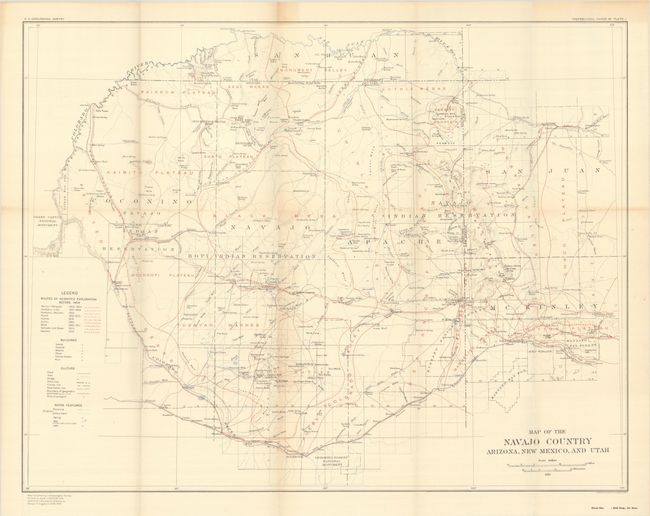
This is Herbert Gregory's 161-page geological report on the region that contains the folding Map of the Navajo Country Arizona, New Mexico, and Utah. The map depicts the Navajo Indian Reservation in northeastern Arizona, northwestern New Mexico, and southeastern Utah. It displays roads. streams, trails, bridges, mines, public buildings. etc. as well as the routes of the scientific explorations before 1909. The report also contains a Geologic Map of the Navajo Country... which has the same base map and is attractively augmented by 16 different geological types. In addition to the maps, there is a plate of geologic sections and numerous full-page photographic plates. Quarto, paper wrappers.
References:
Condition: A
Condition code is for the folding maps and plates, which are mostly clean and bright. Text is very good with a bit of light toning in the last 20 pages or so. There is an old library stamp on the title page, and the paper envelope attached to the inside rear wrapper housing the maps has perished (as is often the case). Paper wrappers have small chips to the spine that have been reinforced with archival tape.