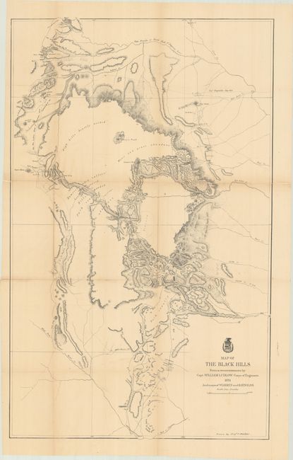
"Map of the Black Hills from a Reconnaissance by Capt. William Ludlow Corps of Engineers", Ludlow, William (Capt.)
Subject: Dakota Territory
Period: 1874 (dated)
Publication: Report of a Reconnaissance of the Black Hills of Dakota...
Color: Black & White
Size:
23.7 x 38.4 inches
60.2 x 97.5 cm
A large map drawn by Sergeant C. Becker and one of three maps resulting from Custer's Expedition with additional geography from the maps of Warren and Raynolds. It covers the Black Hills between the Belle Fourche or North Fork of the Cheyenne River to the South Fork of the Cheyenne. Drawn on a scale of 3 miles=1 inch. Topography is nicely developed with portions of Warren's route of 1857 and that of Raynold's in 1859 shown. This expedition led to a discovery of gold and the subsequent Gold Rush into the Black Hills.
References: Wheat (TMW) #1249.
Condition: B+
Issued folding and now flattened and backed with tissue to reinforce and repair a number of fold separations. There is light toning along the fold lines.