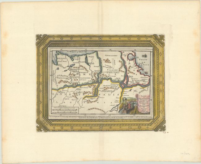
Superb Map of Mississippi River Valley with Picture-Frame Style Border
"Land en Volk-Ontdekking in't Noorder Gedeelte van America, door P. Marquette en Joliet; Gedaan in't Jaar 1673", Aa, Pieter van der
Subject: Central United States
Period: 1719 (circa)
Publication:
Color: Hand Color
Size:
11.5 x 8.8 inches
29.2 x 22.4 cm
Charming copper engraving of the Mississippi River valley with north oriented to the left. It depicts the discoveries of Marquette and Joliet who are pictured in the cartouche. Jolliet and Marquette led the first French expedition down the Mississippi, in 1673. Their expedition was one of the first in the chain of events that would finally lead to French possession of Louisiana. The map extends to Lake Michigan and shows a number of Indian tribes and forts. The map is surrounded by an elaborate picture-frame style border, which was printed from a separate plate. Van der Aa's maps with the separately printed frame borders are much more uncommon than the standard editions without these decorative borders.
References: Tooley (MCC-68) #32.
Condition: A
A sharp impression on a bright, wide-margined sheet with the watermarks of a coat of arms and "Beauvais"(?). There is a bit of foxing along the edges of the sheet.