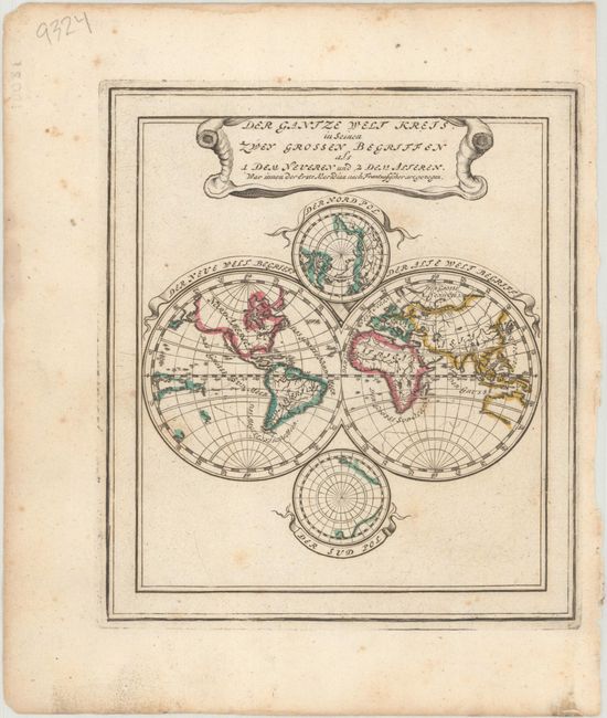
"Der Gantze Welt Kreis in Seinen Zwey Grossen Begriffen als 1 dem Neueren und 2 dem Alteren ... nach Frantzosischer Artgezogen", Stridbeck, Johann
Subject: World
Period: 1720 (circa)
Publication:
Color: Hand Color
Size:
5.2 x 5.9 inches
13.2 x 15 cm
This map was originally issued with an accompanying map on the same sheet, though each has its own platemark. This double hemisphere map shows the world according to French cartographers (the other map showed the Dutch view). California is presented as an island with an indented northern coast. The French are much bolder than the Dutch in their depiction of the northwestern North America. In the Pacific, there are only partial coastlines for New Zealand and Australia, with Tasmania in the Western Hemisphere, but the coast of New Guinea is completely delineated. In the cusps are depictions of the poles, with Antarctica taking shape in the South Pole.
References:
Condition: B+
A nice impression with light foxing and marginal soiling.