Catalog Archive
Auction 193, Lot 168

"Carte de la Partie Nord des Etats Unis de l'Amerique Septentrionale", Bonne, Rigobert

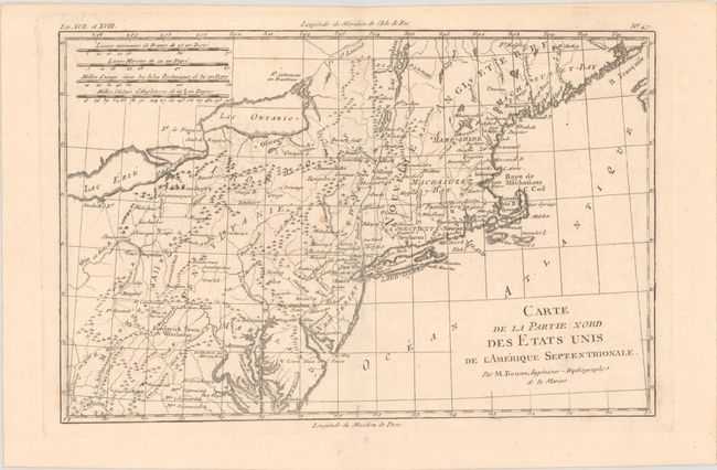
Subject: Colonial New England & Mid-Atlantic United States

Period: 1780 (circa)

Publication: Atlas de Toutes les Parties Connues du Globe Terrestre

Color: Black & White

Size:
12.4 x 8.1 inches
31.5 x 20.6 cm
Download High Resolution Image
(or just click on image to launch the Zoom viewer)

This very early map presents the northern part of the newly-formed United States. It covers the region from northern Virginia to Maine (Machasuzet Bay), and westward to include Lake Erie. The map has good topographical detail, and it also includes numerous settlements, forts, and Indian villages. It locates Baltimore, Annapolis, Alexandria, New York, Boston, Ft. Halifax, and much more. There are four distance scales at upper left.

References: McCorkle #782.1B; Sellers & van Ee #744.

Condition: B+

There are a couple of faint spots in the image.

Estimate: $100 - $130

Sold for: $75

Closed on 6/21/2023

Archived