"The United States of North America", Society for Promoting Christian Knowledge (SPCK)
Subject: United States
Period: 1865 (circa)
Publication:
Color: Hand Color
Size:
15.3 x 12.6 inches
38.9 x 32 cm
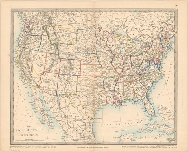
A nice map of the United States showing evolved, but not finalized, western territorial boundaries. A large Dakota territory includes an unnamed region that would become Wyoming (1868) along with a small triangular section jutting into eastern Idaho. The map is filled with place names, forts, Indian tribes, wagon roads, rivers, topography, notations, and more. Constructed and engraved at Stanford's Geographical Establishment, and published by the Society for Promoting Christian Knowledge in London.
The Society for Promoting Christian Knowledge (more commonly known as SPCK) is the oldest Anglican mission organization, founded in 1698 by Thomas Bray. From its earliest days SPCK commissioned tracts and pamphlets, making it the third oldest publishing house in England (closely following the Oxford and Cambridge University Presses). They published a broad range of material including pamphlets aimed at specific groups such as farmers, prisoners, soldiers, seamen, servants, and slave-owners, general religious works, devotional literature, and, from the 1830s onwards, on general educational topics.
References:
Condition: B+
There is light toning along the centerfold and a couple of ink spots along the left border. Short centerfold separations confined to the top and bottom blank margins have been closed on verso with archival tape, and there is a small chip along the bottom sheet edge.