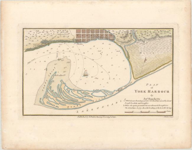
Early Plan of Toronto
"Plan of York Harbour", Bouchette, Joseph
Subject: Toronto, Ontario
Period: 1815 (dated)
Publication:
Color: Hand Color
Size:
8.9 x 5.2 inches
22.6 x 13.2 cm
This early plan shows the harbor and settlement of York, which at the time was the capital of Upper Canada. It was re-named Toronto in 1834. In 1793, surveyor Joseph Bouchette laid out the grid of streets for the Town of York on the shores of the natural protected harbor created by the Peninsula (later to become the Toronto Islands). This map shows the wreck location of the H.M.S. Anandaga on the sandy shoal at the harbor entrance. Engraved by J. Walker. Features the publisher's imprint of William Faden, dated 1815.
References:
Condition: A
There is light foxing in margins.