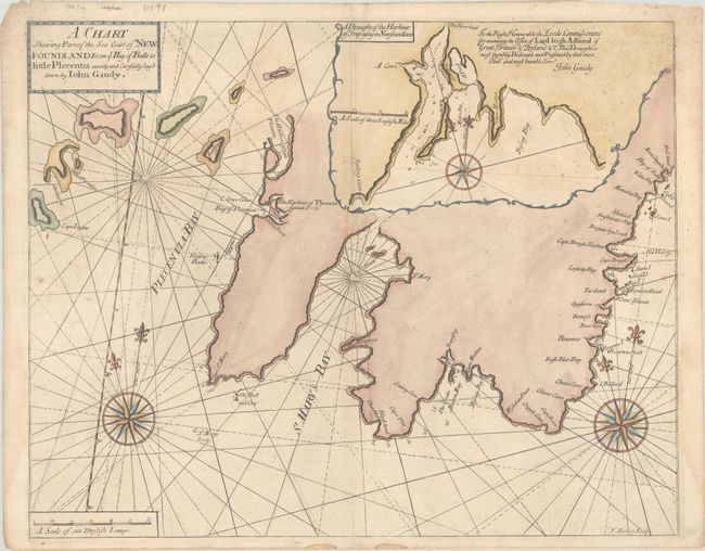
"A Chart Shewing Part of the Sea Coast of Newfoundland from ye Bay of Bulls to Little Plecentia Exactly and Carefully Lay'd Down by Iohn Gaudy", Mount & Page
Subject: Newfoundland, Canada
Period: 1748 (circa)
Publication: The English Pilot. The Fourth Book
Color: Hand Color
Size:
21.9 x 17.4 inches
55.6 x 44.2 cm
This uncommon British chart of the east coast of the Avalon Peninsula was created of Lt. John Gaudy, who was commissioned to survey the region in 1716 as a direct result of the Treaty of Utrecht (1713), in which France conceded British sovereignty over Newfoundland. The coastline extends from Placentia Harbor to the Bay of Bulls, and an inset map at top right gives greater detail of the area around Mutton Bay and Biscay Bay. The map is adorned with two large compass roses. Engraved by Samuel Parker.
References: Shirley (BL Atlases) M.M&P-5a #6.
Condition: B+
There is some scattered foxing and very faint dampstains in the upper third of the image. Additional small dampstains at left and right are almost entirely confined to the blank margins.