"Carte Generale de l'Ile et des Bancs de Terre-Neuve et du Golfe Saint Laurent...", Robiquet, Aime
Subject: Eastern Canada
Period: 1852 (dated)
Publication:
Color: Black & White
Size:
38.6 x 25.9 inches
98 x 65.8 cm
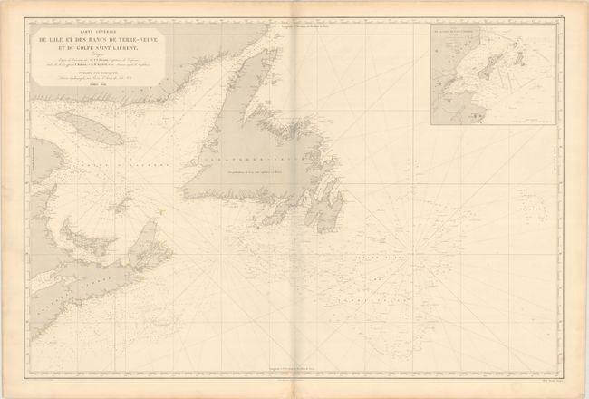
This large sea chart focuses on the Gulf of St. Lawrence and the Grand Banks of Newfoundland. The banks are identified with dotted lines and the waters are filled with depth soundings and notes on the types of sediment found on the sea floor. The locations of lighthouses are hand colored in yellow. Numerous place names are identified along the coasts, but the interior remains blank. An inset at top right details the eastern coast of Saint Pierre, the territorial overseas collectivity of France. The map is based on French and British sources. Drawn by A. Vuillemin and engraved by Tardieu.
References:
Condition: B+
Light soiling and minor toning with a short centerfold separation in the bottom margin. There is a grayish shadow along the centerfold in the image that is caused by our scanner and doesn't appear on the map itself.