Catalog Archive
Auction 180, Lot 343
"Carte de l'Isle de Sainte Croix au Sud des Isles des Vierges [on sheet with] Carte de l'Isle de St Jean de Portorico", Bellin, Jacques Nicolas
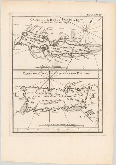
Subject: Puerto Rico & Saint Croix
Period: 1764 (circa)
Publication: Le Petit Atlas Maritime
Color: Black & White
Size:
6.7 x 8.6 inches
17 x 21.8 cm
Download High Resolution Image
(or just click on image to launch the Zoom viewer)
(or just click on image to launch the Zoom viewer)