"Molokai", Hawaii Territorial Surveys
Subject: Moloka'i, Hawaii
Period: 1897 (dated)
Publication:
Color: Printed Color
Size:
48.3 x 25.2 inches
122.7 x 64 cm
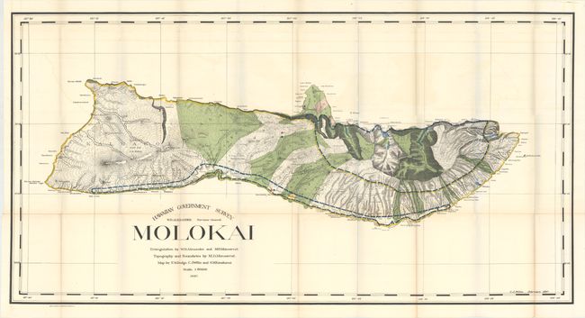
This first edition map is filled with details including topography, watershed, villages, land grants, coastal detail, lava flows, and property owners. On the northern side of the island is an area of about six square miles dedicated to a leper colony of about 100 souls (Kalaupapa). It was established in 1866 and considered one of the most remarkable institutions of its kind in existence. Triangulation was performed by W.D. Alexander and M.D. Monsarrat, who also did the boundaries and topography. The map was drawn by F.S. Dodge, C.J. Willis, and S.M. Kanakanui. A fascinating map of this beautiful island.
References:
Condition: B+
Issued folding with faint color offsetting and several small splits at fold intersections.