Catalog Archive
Auction 158, Lot 248

"Anglia Regnum in Omnes Suos Ducatus, Comitatus, et Provincias Divisum ", Wit, Frederick de

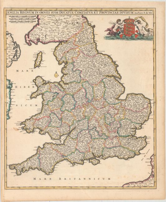
Subject: England & Wales

Period: 1680 (circa)

Publication:

Color: Hand Color

Size:
19.1 x 22.8 inches
48.5 x 57.9 cm
Download High Resolution Image
(or just click on image to launch the Zoom viewer)

This is the scarce first edition of De Wit's handsome map of England and Wales. It is fully engraved to show hundreds of towns and rivers throughout, and political boundaries are well delineated. Curiously, all of the hills are missing on this edition, as well as some place names, which Shirley suggests may be evidence that this is a proof state. The Royal Arms of England appears at top, flanked by sea monsters and mer-folk.

References: Shirley (BI to 1750) De Wit 5 #1.

Condition: B+

Original color with a stain west of Pembrokeshire and very light, scattered foxing.

Estimate: $550 - $700

Unsold

Closed on 6/22/2016

Archived