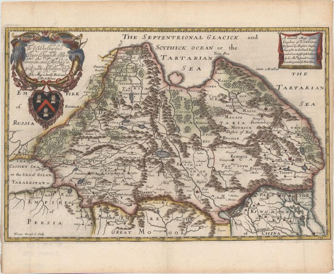
"A Generall Mapp of the Kingdome of Tartaria, Designed by Monsieur Sanson...", Blome, Richard
Subject: Northern Asia
Period: 1670 (circa)
Publication: Geographical Description of the Four Parts Of The World
Color: Hand Color
Size:
15.4 x 10.2 inches
39.1 x 25.9 cm
This elaborately engraved map covers northern and central Asia, at the time, the Kingdom of Tartary. To the south are the empires of Persia, The Great Mogol, and China. This map is based on the cartography of Nicolas Sanson and was engraved by Thomas Burnford. Richard Blome was one of the most interesting, and most active, publishers of illustrated books in post-Restoration London. The map is embellished with a large, heraldic cartouche including a dedication to Roger Vaughan. There is an excellent biography of Blome on href="http://www.mapforum.com/09/9blome.htm">MapForum.com.
References: Shirley (BL Atlases) T.BLOM-1a #8.
Condition: A
Issued folding on watermarked paper. Minor toning in blank margins with close (1/8") side margins, as issued.