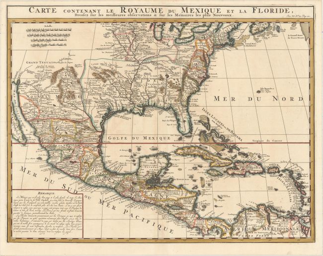
"Carte Contenant le Royaume du Mexique et la Floride, Dressez sur les Meilleures Observations & sur les Memoires les Plus Nouveaux", Chatelain, Henry Abraham
Subject: North America
Period: 1719 (circa)
Publication: Atlas Historique…
Color: Hand Color
Size:
20.6 x 15.9 inches
52.3 x 40.4 cm
This is a derivative of Delisle's landmark map of the southern part of North America and the West Indies. The detailed map shows many English settlements along the East Coast and carefully notes the discoveries of D'Iberville along the Gulf Coast and Mississippi River. The vast region, later known as Louisiana, from Florida through present-day Texas is shown as the French possession of Floride. There is also a great amount of detail in Nouveau Mexique, particularly of the Spanish missions: Santa Fe, Taos, and Acoma.
References: Martin & Martin, p. 93.
Condition: A
A dark, crisp impression on watermarked paper with attractive color and a hint of toning along the centerfold. There are a few tiny worm holes along the centerfold that have been professionally infilled.