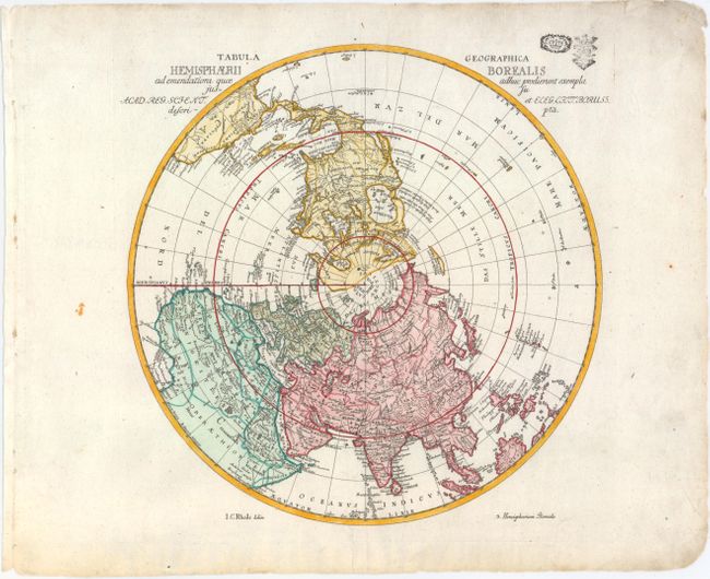
"Tabula Geographica Hemisphaerii Borealis ad Emendatiora quae Adhuc Prodierunt Exempla...", Rhode, Johann Cristoph
Subject: North Pole
Period: 1750 (circa)
Publication:
Color: Hand Color
Size:
12.2 x 12 inches
31 x 30.5 cm
This interesting and uncommon polar map shows the fictitious West-Meer, or Sea of the West prominently with an extensive river system connecting it with the Great Lakes and thus forming a Northwest Passage. The mythical See Velasco is named near present-day Alaska with a note about Admiral de Fonte's mythical journey across the Northwest Passage in 1640. Johann Cristoph Rhode (1713-1786) was an active publisher in Berlin during the 1740s and 50s and is best known for his important French and Indian War maps. This map was prepared for the Royal Prussian Academy of Sciences and was published in the atlas of Leonhard Euler, whose stamps appear at top right. It is the first state, with "3. Hemisphaerium Boreale" at bottom right.
References: McGuirk #27.
Condition: A
On a watermarked sheet with some marginal soiling. There are two stamped seals above the title at top right.