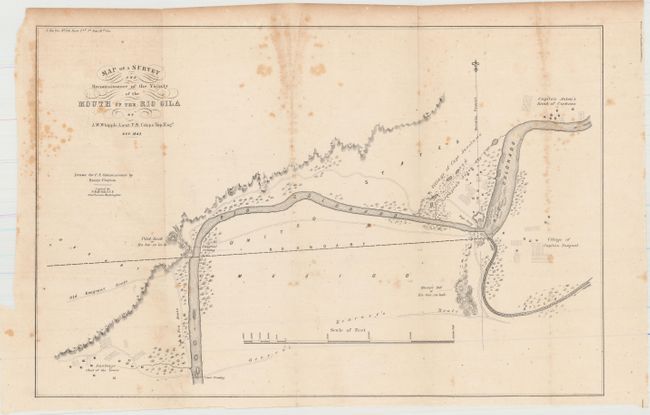
"[Map with Report] Map of a Survey and Reconnaissance of the Vicinity of the Mouth of the Rio Gila", Whipple, Amiel Weekes
Subject: Arizona and Mexico
Period: 1849 (dated)
Publication: Sen. Ex. Doc. 34, 31st Congress. 1st Session
Color: Black & White
Size:
16.5 x 11 inches
41.9 x 27.9 cm
This map illustrates a critical aspect of the Mexican Boundary Survey (following the Treaty of Guadeloupe Hidalgo) with the determination of an agreed upon point (the middle of the Rio Gila where it enters the Colorado) to anchor the boundary line in the east. Shows the villages of Captain Pasqual, Capt. Anastasio, and Captain Anton in the vicinity of Yuma. Also shows the Old Emigrant Route and General Kearney's Route. Locates a rope crossing, the emigrant crossing and the lower crossing east of Santiago. An important and historical map that is finely engraved with good detail along the rivers.
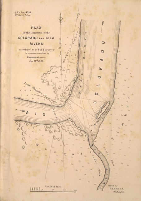
Included with the map is 22 pages of text from the report including two small maps (each approx 5.5 x 8"): "Plan of the Junction of the Colorado and Gila Rivers…" and an untitled map of the same geography showing the boundary line. Octavo, hardbound in half green faux leather over marbled boards.
References: Wheat (TMW) #653.
Condition: B
Condition code is for the maps which have scattered foxing. Text is clean and tight and the new binding is excellent.