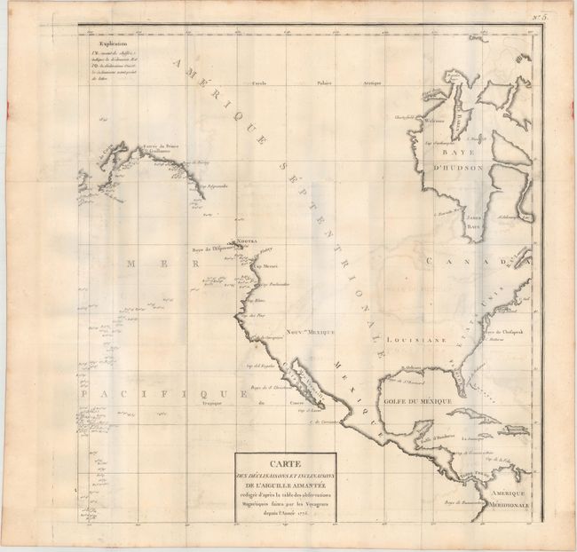
"Carte des Declinaisons et Inclinaisons de l'Aiguille Aimantee Redigee d'Apres la Table des Observations Magnetiques Faites par les Voyageurs Depuis l'Annee 1775", Buffon, Comte de
Subject: North America, Pacific Ocean
Period: 1780 (circa)
Publication: Naturelle Histoire des Mineraux
Color: Black & White
Size:
21.8 x 22.3 inches
55.4 x 56.6 cm
This chart is sheet number 5 from a series of 8 maps and covers all of North America with an emphasis on the west coast. Many place names are identified including Cap Blanc, Cap Foulweather and Nootka with the coastline only partially mapped. The ocean is filled with magnetic readings from various explorers after 1775. Published in Buffon's Histoire Naturelle Histoire des Mineraux. Please see for the map of eastern Asia from this same set that could be joined to form a larger map depicting the entire northern Pacific Ocean.
References:
Condition: B+
Issued folding on heavy, watermarked paper with light offsetting and a few tiny spots in the image. Please note that the blue hue in the image is caused by our scanner and not in the physical map.