"[Lot of 3 - Scotland]", Mercator, Gerard
Subject: Scotland
Period: 1609 (circa)
Publication:
Color: Hand Color
A very nice matched set of Mercator's maps of Scotland from an early French edition of the Mercator-Hondius Atlas.
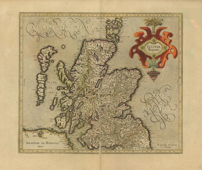
Scotia, Regnum, (16 x 13.8").
This beautifully engraved map shows all of Scotland and the Hebrides islands with a stippled sea and strong topographical features in the interior. It was compiled from Mercator's landmark map of the British Isles [1564] with some corrections. Mercator's outline of Scotland remained the standard until the Robert Gordon map was published by Blaeu in 1654. Original color on full sheet with very wide margins. Color is slightly faded and map is split in lower half along centerfold. (C)
Scotiae Regnum, (18 x 13.8" - each). This is Mercator's pair of maps covering the whole of Scotland. The cartography shows the influence of an earlier map by Nicolas de Nicolay. Mercator's depiction of Cape Wrayght or Faro Head was to influence maps of Scotland for almost two centuries. The map is richly engraved with a moiré pattern to the seas and strong topographical features in the interior. The northern map includes the strapwork title cartouche, while the southern section is untitled and decorated with a single sailing ship. Both beautiful, early impressions with original color that is slightly faded and very wide margins. Occasional foxing in the wide, blank margins. Map images are very good. (B+)
References:
Condition:
See individual descriptions.