Catalog Archive
Auction 128, Lot 44

"Carta Hydrographica oder Algemeine Welt und Commercien Carte…", Stridbeck/Bodenehr
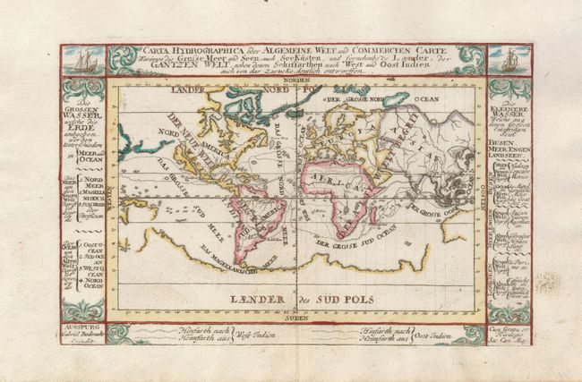
Subject: World

Period: 1730 (circa)

Publication:

Color: Hand Color

Size:
9 x 5.8 inches
22.9 x 14.7 cm
Download High Resolution Image
(or just click on image to launch the Zoom viewer)

An uncommon world map that shows the Dutch commercial interests in the East and West Indies. The map combines several cartographic myths including the island of California, the great southern landmass (here labeled Laender des Sud Pols), and an unnamed landmass situated between Asia and North America. Two ships decorate the map at the top with columns of Dutch text at sides. Within the map, the trade routes to and from the East and West Indies are traced.

References:

Condition: A

Light surface soil, mostly in the blank margins.

Estimate: $350 - $425

Unsold

Closed on 5/20/2009

Archived