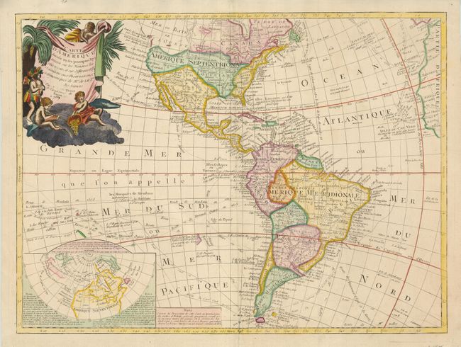
"Carte d'Amerique divisee en ses principaux Pays Dressee sur les Memoires les plus recents, et sur Differents Voyages", Clouet, Jean Baptiste Louis
Subject: Western Hemisphere
Period: 1787 (dated)
Publication:
Color: Hand Color
Size:
25 x 18.5 inches
63.5 x 47 cm
This scarce map exhibits some speculative cartography on the Pacific coast of North America. A huge Mer ou Baye de l'Ouest dominates the northwest coast, but a tentative coastline also reflects the Russian discoveries in the region. The large inset map illustrates the theories of Joseph Delisle and Philippe Buache concerning the potential Northwest Passage and the Sea of the West. In the Pacific, the tracks of early explorers are shown, including Quiros, Mendana, Le Maire, Magellan, and Antoine.
References:
Condition: B
The impression is a bit uneven and the bottom centerfold has been repaired with a small section of paper restoration and ink facsimile of a few letters.