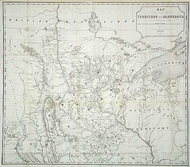
"Map of the Territory of Minnesota Exhibiting the Route of the Expedition to the Red River of the North, in the Summer of 1849", Pope, John
Subject: Minnesota
Period: 1849 (dated)
Publication: Senate Doc. 42, 31st Cong., 1st Sess.
Color: Black & White
Size:
28 x 24.5 inches
71.1 x 62.2 cm
A foundation map for Minnesota from Pope's Report of an Exploration of the Territory of Minnesota and based on Nicollet's earlier "Map of the Hydrographical Basin of the Upper Mississippi River." Pope has increased the coverage to include the Lake of the Woods and Canada (British Possessions), and added much new information on rivers and lakes. The map is considered the first published map to show the newly formed territory by itself. Details Pope's route from Fort Snelling to the Red River and back. Proposed lines of railroad grants are drawn in. Terrific detail of hydrography and topography. Drawn by P.S. Morawski.
References: Karrow(a) No.7-0659: Phillips(a) p.432.
Condition: A+
Good impression on bright paper. One tiny spot. Remarkable condition for a folding map of this size.