Showing No Reserve Lots(remove filter)
Showing results for:Auction 151
Catalog Archive
14 lots
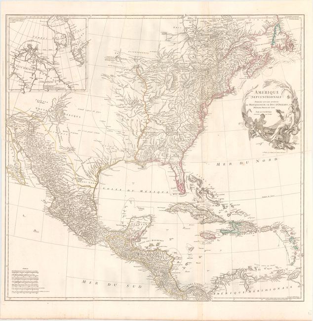
Auction 151, Lot 76
Subject: North America
Anville, Jean Baptiste Bourguignon d'
Amerique Septentrionale Publiee sous les Auspices de Monseigneur le Duc d'Orleans Premier Prince du Sang, 1746
Size: 34.1 x 32.8 inches (86.6 x 83.3 cm)
Estimate: $1,500 - $1,800
NO RESERVE
Sold for: $950
Closed on 11/19/2014
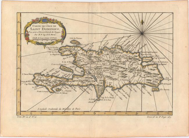
Auction 151, Lot 372
Subject: Hispaniola
Bellin, Jacques Nicolas
[Lot of 2] Carte de l'Isle de Saint Domingue [and] Ville de S. Domingue dans l'Isle de ce Nom, 1758-64
Size: See Description
Estimate: $140 - $170
NO RESERVE
Sold for: $85
Closed on 11/19/2014
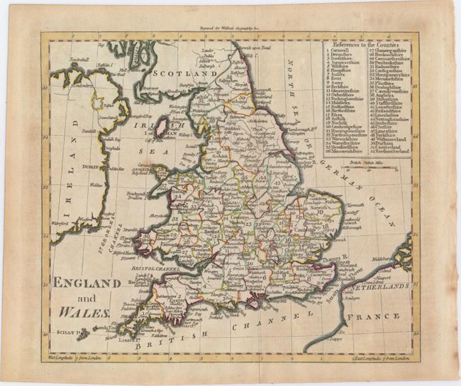
Auction 151, Lot 466
Subject: England & Wales
Walker, John
England and Wales, 1797
Size: 8.5 x 7.4 inches (21.6 x 18.8 cm)
Estimate: $90 - $120
NO RESERVE
Sold for: $33
Closed on 11/19/2014
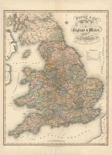
Auction 151, Lot 467
Subject: England & Wales
Pigot, James & Co.
Pigot & Co.'s New Map of England &Wales. With Part of Scotland. Including the New Lines of Canals, Rail Roads &c., 1838
Size: 20.8 x 26.7 inches (52.8 x 67.8 cm)
Estimate: $130 - $160
NO RESERVE
Sold for: $80
Closed on 11/19/2014
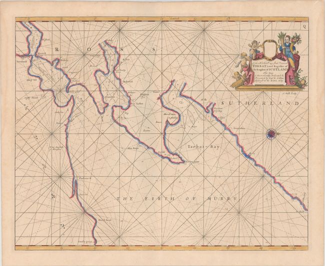
Auction 151, Lot 473
Subject: Moray Firth, Scotland
Collins, Capt. Greenvile
To the Rt. Honble. My Lord Viscount Torbat Lord Register of the Kingdom of Scotland This Map Is Most Humbly Dedicated & Presented by Capt. G. Collins Hydroghe. to the King, 1689
Size: 22 x 17.4 inches (55.9 x 44.2 cm)
Estimate: $220 - $250
NO RESERVE
Sold for: $120
Closed on 11/19/2014
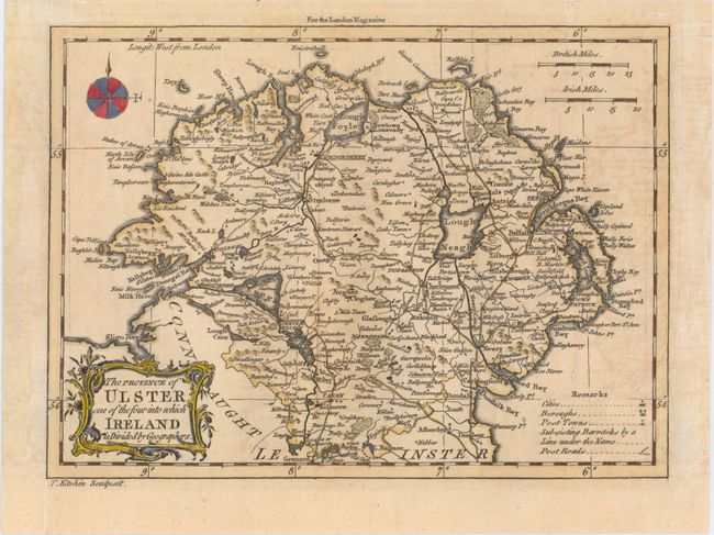
Auction 151, Lot 475
Subject: Northern Ireland
Kitchin, Thomas
The Province of Ulster, One of the Four Into Which Ireland Is Divided by Geographers, 1766
Size: 9.1 x 6.7 inches (23.1 x 17 cm)
Estimate: $70 - $90
NO RESERVE
Sold for: $26
Closed on 11/19/2014
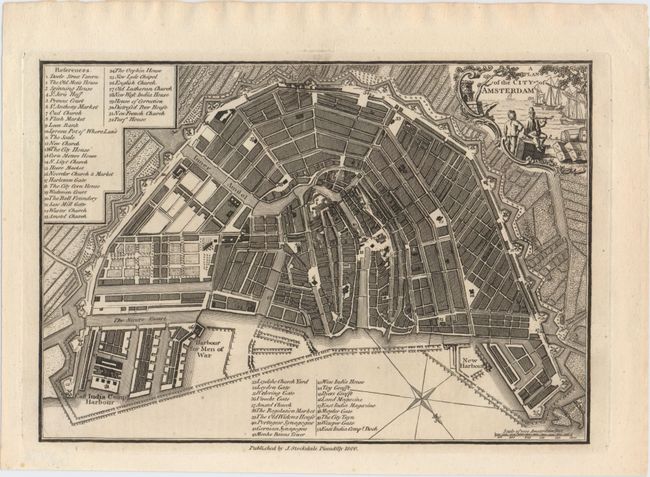
Auction 151, Lot 492
Subject: Amsterdam, Netherlands
Stockdale, John
A Plan of the City of Amsterdam, 1800
Size: 10.1 x 7 inches (25.7 x 17.8 cm)
Estimate: $100 - $140
NO RESERVE
Sold for: $37
Closed on 11/19/2014
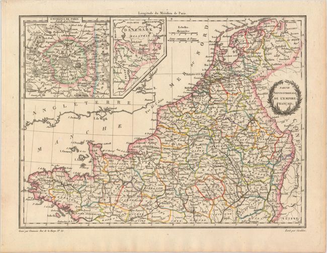
Auction 151, Lot 504
Subject: France
Malte-Brun, Conrad
[Lot of 2] Partie Septentrionale de l'Empire Francais [and] Partie Occidentale de l'Empire Francais, 1812
Size: 11.9 x 8.8 inches (30.2 x 22.4 cm)
Estimate: $60 - $80
NO RESERVE
Sold for: $28
Closed on 11/19/2014
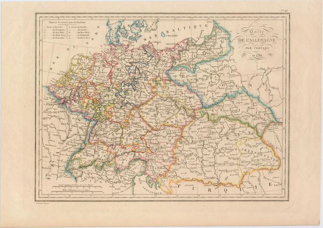
Auction 151, Lot 518
Subject: Central Europe
Malte-Brun, Conrad
Carte de l'Allemagne par Cercles en 1789, 1837
Size: 12 x 8.9 inches (30.5 x 22.6 cm)
Estimate: $50 - $70
NO RESERVE
Sold for: $27
Closed on 11/19/2014
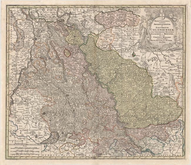
Auction 151, Lot 523
Subject: Western Germany
Seutter, Matthias
Mappa Geographica, Continens Archiepiscopatum et Electoratum Coloniensem, cum Conterminis Ducatibus Iuliacensi et Montensi, nec non Comitatu Mursano, Cura et Sumtibus, 1740
Size: 23.1 x 19.9 inches (58.7 x 50.5 cm)
Estimate: $140 - $170
NO RESERVE
Sold for: $33
Closed on 11/19/2014
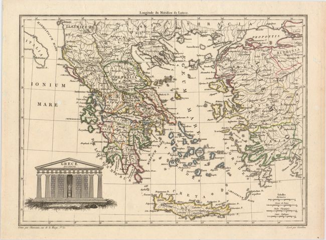
Auction 151, Lot 554
Subject: Greece
[Lot of 2] Grece Ancienne [and] La Laconie, la Messenie et l'Ile de Cythere, 1812-20
Size: See Description
Estimate: $60 - $80
NO RESERVE
Sold for: $30
Closed on 11/19/2014
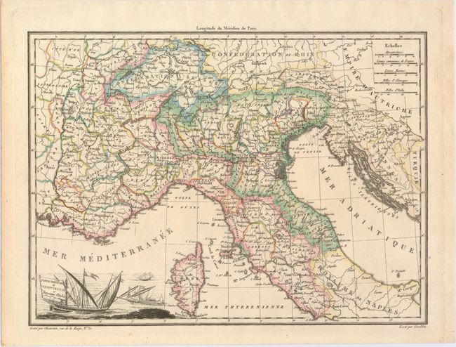
Auction 151, Lot 560
Subject: Italy
[Lot of 3] Partie Orientale de l'Empre. Francais et Royaume d'Italie [and] Italy I [and] Italy III, 1812-32
Size: See Description
Estimate: $80 - $110
NO RESERVE
Sold for: $33
Closed on 11/19/2014
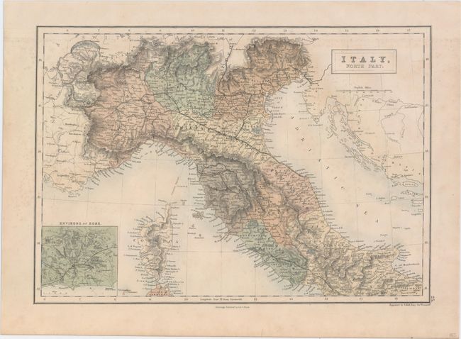
Auction 151, Lot 561
Subject: Italy
Black, Adam & Charles
[Lot of 2] Italy, North Part [and] Italy, South Part, 1862
Size: 14.9 x 10.4 inches (37.8 x 26.4 cm)
Estimate: $130 - $160
NO RESERVE
Sold for: $33
Closed on 11/19/2014
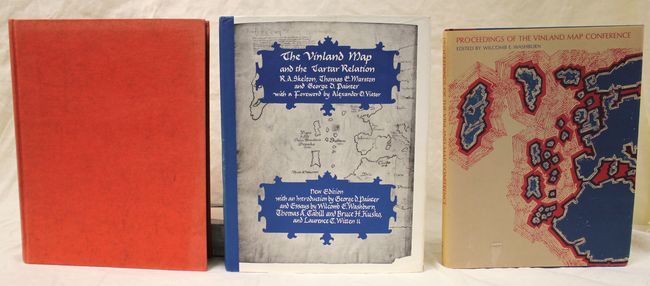
Auction 151, Lot 765
Subject: References
[Lot of 3] The Vinland Map and the Tartar Relation [and] The Vinland Map and the Tartar Relation ... New Edition [and] Proceedings of the Vinland Map Conference, 1965-95
Size: See Description
Estimate: $100 - $140
NO RESERVE
Sold for: $55
Closed on 11/19/2014
14 lots