Showing Featured Lots(remove filter)
Showing results for:Auction 145
Catalog Archive
92 lots
Page 1 of 2
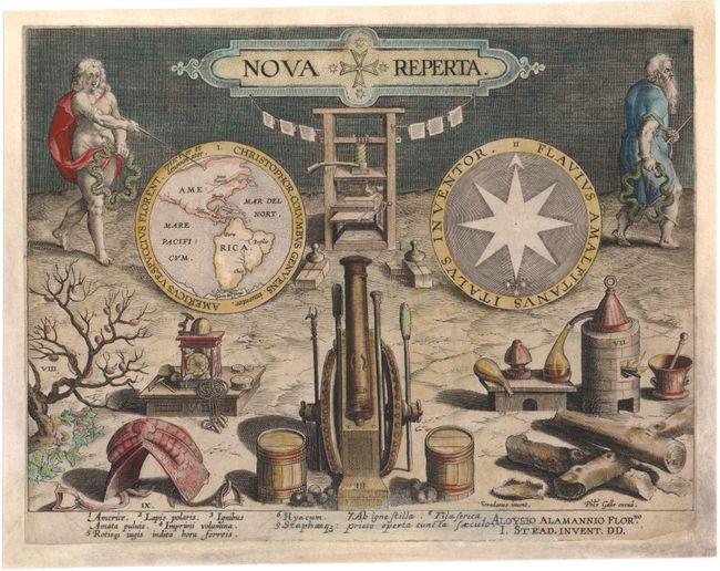
Auction 145, Lot 3
Subject: Title Pages, Western Hemisphere
Galle/Stradanus
Nova Reperta, 1600
Size: 10.5 x 8 inches (26.7 x 20.3 cm)
Estimate: $700 - $850
Unsold
Closed on 6/12/2013
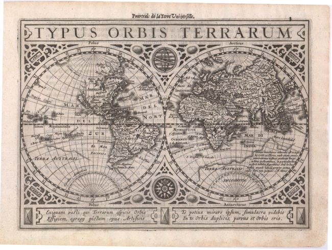
Auction 145, Lot 10
Subject: World & Continents
Mercator/Jansson
[Lot of 5] Typus Orbis Terrarum [and] Americae Descriptio [and] Africae Descriptio [and] Asia [and] Europae Nova Tabula, 1628
Size: 8 x 5.8 inches (20.3 x 14.7 cm)
Estimate: $1,900 - $2,100
Sold for: $2,300
Closed on 6/12/2013
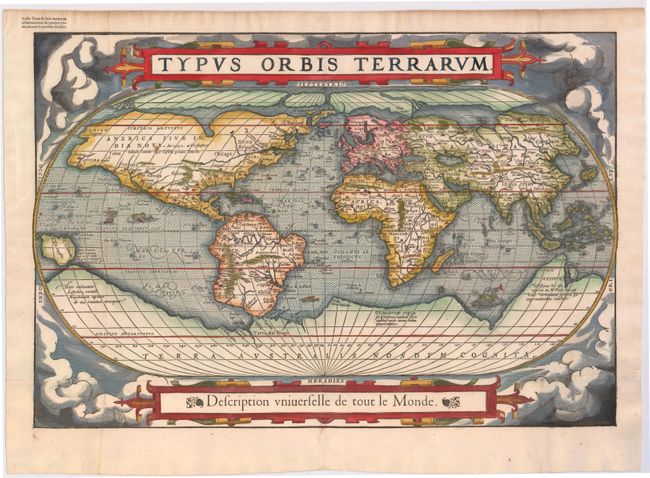
Auction 145, Lot 11
Subject: World
Belleforest, Francois
Typus Orbis Terrarum, 1575
Size: 19.5 x 13.2 inches (49.5 x 33.5 cm)
Estimate: $5,000 - $6,000
Scarce Woodcut Version of Ortelius’ World Map
Sold for: $3,500
Closed on 6/12/2013
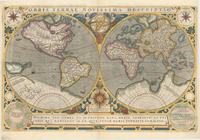
Auction 145, Lot 13
Subject: World
Hondius/Le Clerc
Orbis Terrae Novissima Descriptio, 1633
Size: 20.2 x 13 inches (51.3 x 33 cm)
Estimate: $5,500 - $6,500
Rare World Map by Le Clerc
Unsold
Closed on 6/12/2013
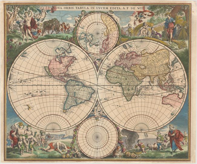
Auction 145, Lot 16
Subject: World
Wit, Frederick de
Nova Orbis Tabula, in Lucem Edita, 1670
Size: 22.5 x 18.9 inches (57.2 x 48 cm)
Estimate: $4,750 - $5,500
De Wit's Stunning Double-Hemisphere Map with Gilt Highlights
Unsold
Closed on 6/12/2013
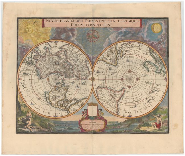
Auction 145, Lot 19
Subject: World
Blaeu/Valck
Novus Planiglobii Terrestris per Utrumque Polum Conspectus, 1695
Size: 21.1 x 15.9 inches (53.6 x 40.4 cm)
Estimate: $7,500 - $9,500
Superb World Map on a Polar Projection
Unsold
Closed on 6/12/2013
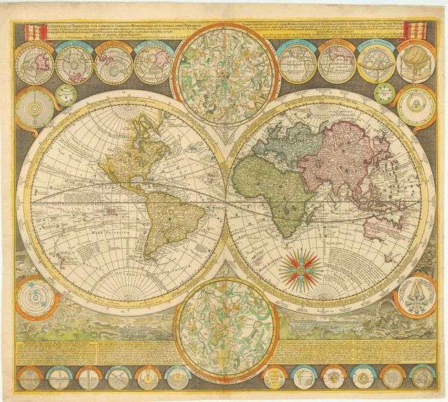
Auction 145, Lot 20
Subject: World
Zurner, Adam Friedrich
Planisphaerium Terrestre cum Utroque Coelesti Hemisphaerio, sive Diversa Orbis Terraquei..., 1700
Size: 23 x 20 inches (58.4 x 50.8 cm)
Estimate: $4,750 - $5,500
Sold for: $2,750
Closed on 6/12/2013
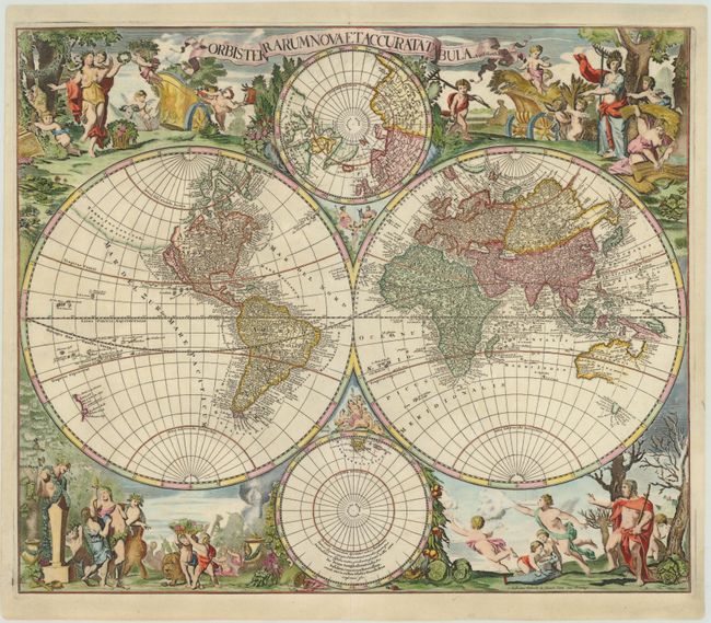
Auction 145, Lot 21
Subject: World
Valck, Gerard and Leonard
Orbis Terrarum Nova et Accurata Tabula, 1700
Size: 22.5 x 19 inches (57.2 x 48.3 cm)
Estimate: $6,000 - $7,000
Sold for: $3,500
Closed on 6/12/2013
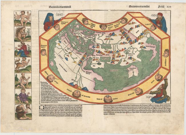
Auction 145, Lot 40
Subject: Ancient World
Schedel, Hartmann
Secunda Etas Mundi, 1493
Size: 17.2 x 12.2 inches (43.7 x 31 cm)
Estimate: $12,000 - $14,000
Schedel's Ancient World Map
Sold for: $11,500
Closed on 6/12/2013

Auction 145, Lot 51
Subject: Celestial
Cellarius, Andreas
Solis Circa Orbem Terrarum Spiralis Revolutio, 1661
Size: 19.5 x 17 inches (49.5 x 43.2 cm)
Estimate: $2,400 - $3,000
Sold for: $1,400
Closed on 6/12/2013
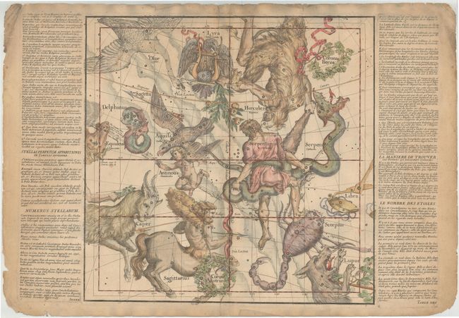
Auction 145, Lot 52
Subject: Celestial
[Untitled - Celestial Chart], 1693
Size: 19 x 18.8 inches (48.3 x 47.8 cm)
Estimate: $1,400 - $1,600
Rare Celestial Chart by Pardies
Sold for: $700
Closed on 6/12/2013
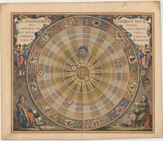
Auction 145, Lot 54
Subject: Solar System
Cellarius, Andreas
Planisphaerium Copernicanum sive Systema Universi Totius Creati ex Hypothesi Copernicana in Plano Exhibitum, 1661
Size: 20.6 x 17.2 inches (52.3 x 43.7 cm)
Estimate: $2,400 - $3,000
One of the Most Sought-after Charts from this Famous Work
Sold for: $1,900
Closed on 6/12/2013
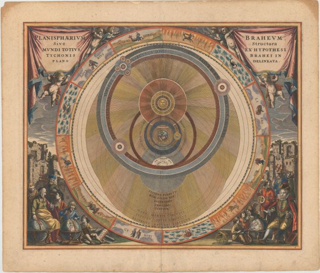
Auction 145, Lot 55
Subject: Solar System
Cellarius, Andreas
Planisphaerium Braheum, sive Structura Mundi Totius, ex Hypothesi Tychonis Brahei in Plano Delineata, 1661
Size: 20.3 x 16.5 inches (51.6 x 41.9 cm)
Estimate: $2,750 - $3,500
Sold for: $2,000
Closed on 6/12/2013
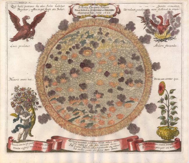
Auction 145, Lot 58
Subject: Sun
Zahn, Johannes
Schema Corporis Solaris prout Romae a Scheinero et Kirchero Observatum fuit, 1696
Size: 16.5 x 14 inches (41.9 x 35.6 cm)
Estimate: $900 - $1,100
Sold for: $650
Closed on 6/12/2013
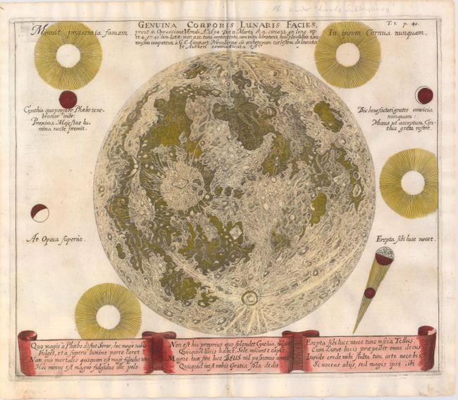
Auction 145, Lot 59
Subject: Moon
Zahn, Johannes
Genuina Corporis Lunaris Facies, prout in Oppositione Vernali..., 1696
Size: 16.5 x 13.7 inches (41.9 x 34.8 cm)
Estimate: $900 - $1,100
Sold for: $650
Closed on 6/12/2013
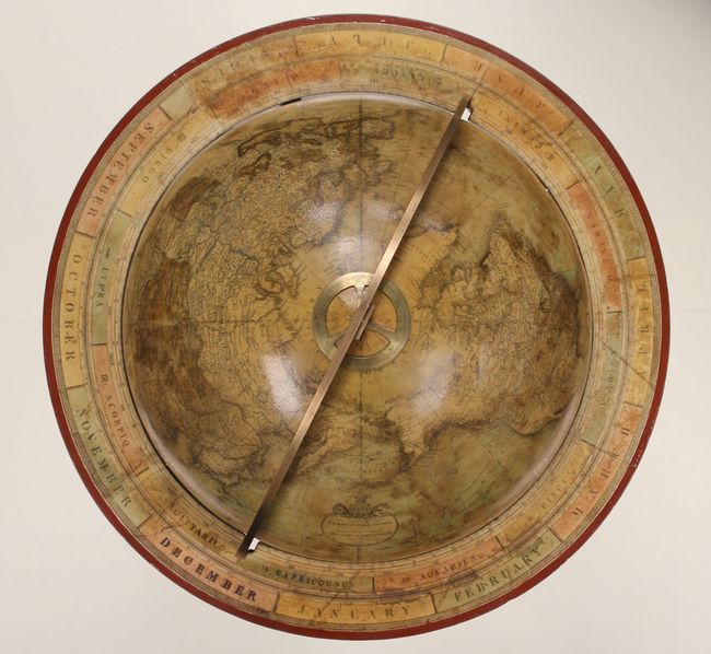
Auction 145, Lot 61
Subject: Globes
Loring, Josiah
[18-inch Terrestrial Globe] Loring's Terrestrial Globe Containing All the Late Discoveries and Geographical Improvements..., 1832
Size: 25 x 44 inches (63.5 x 111.8 cm)
Estimate: $20,000 - $25,000
Earliest Example of a Loring Terrestrial Globe
Sold for: $13,000
Closed on 6/12/2013
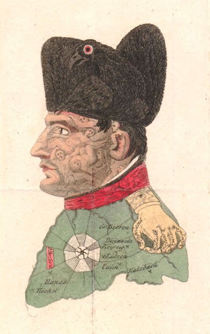
Auction 145, Lot 65
Subject: Cartographic Miscellany, Napoleon, Germany
[Lot of 2 - Napoleon Bonaparte Portrait], 1814
Size: 2.5 x 4 inches (6.4 x 10.2 cm)
Estimate: $600 - $800
Famous Caricature of Napoleon
Sold for: $450
Closed on 6/12/2013
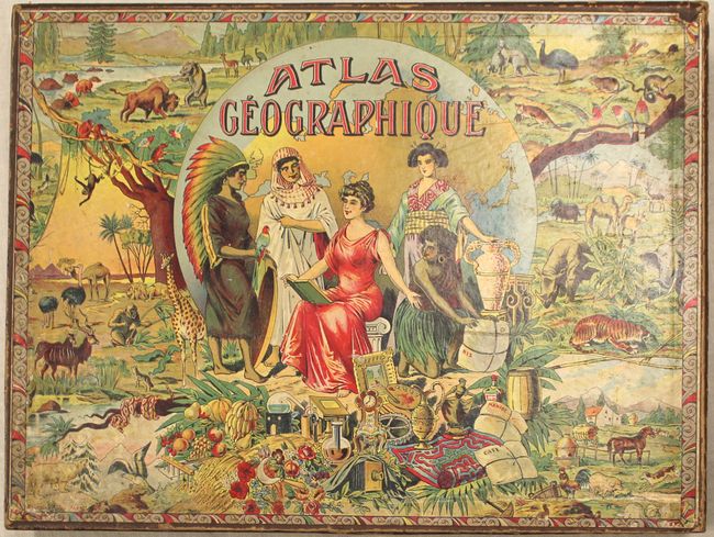
Auction 145, Lot 68
Subject: Cartographic Miscellany
Pauly, G.
[Puzzle] Atlas Geographique, 1920
Size: 13.3 x 9.5 inches (33.8 x 24.1 cm)
Estimate: $550 - $650
Sold for: $400
Closed on 6/12/2013
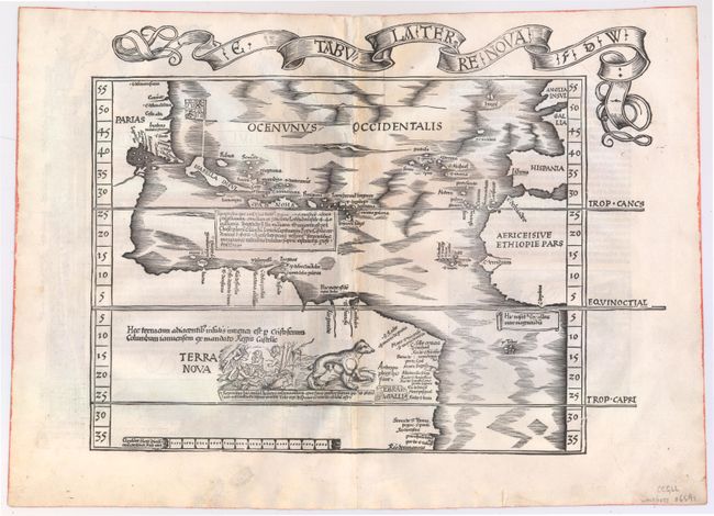
Auction 145, Lot 69
Subject: Western Hemisphere - America, Atlantic Ocean
Waldseemuller/Fries
E. Tabula Terre Nova F.D.W., 1522
Size: 17.1 x 12.8 inches (43.4 x 32.5 cm)
Estimate: $21,000 - $25,000
Rare First Issue of the Waldseemuller/Fries "Admiral's Map"
Unsold
Closed on 6/12/2013
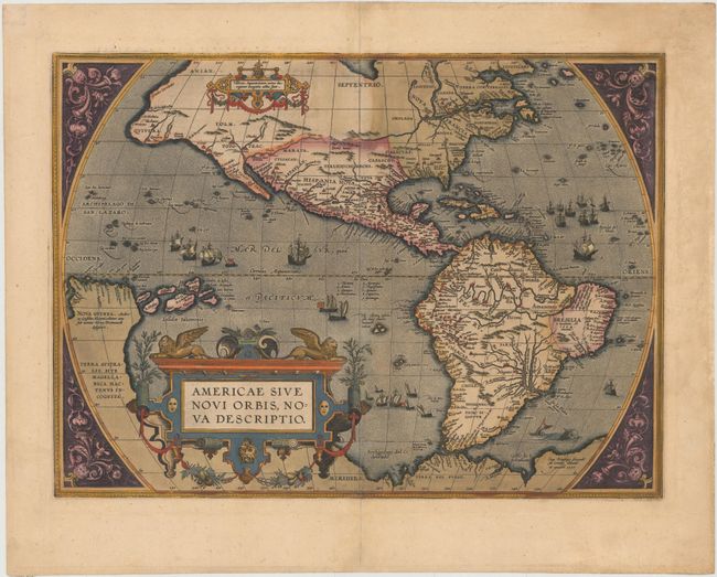
Auction 145, Lot 70
Subject: Western Hemisphere - America
Ortelius, Abraham
Americae sive Novi Orbis, Nova Descriptio, 1587
Size: 19.2 x 14 inches (48.8 x 35.6 cm)
Estimate: $6,000 - $7,000
Ortelius' Influential Map of the New World - Full Original Color
Sold for: $4,500
Closed on 6/12/2013
Auction 145, Lot 71
Subject: Western Hemisphere - America
Blaeu, Willem
Americae Nova Tabula, 1640
Size: 21.9 x 16.2 inches (55.6 x 41.1 cm)
Estimate: $6,000 - $7,000
Blaeu's Stunning Carte-a-Figures Map of the Americas
Sold for: $4,500
Closed on 6/12/2013
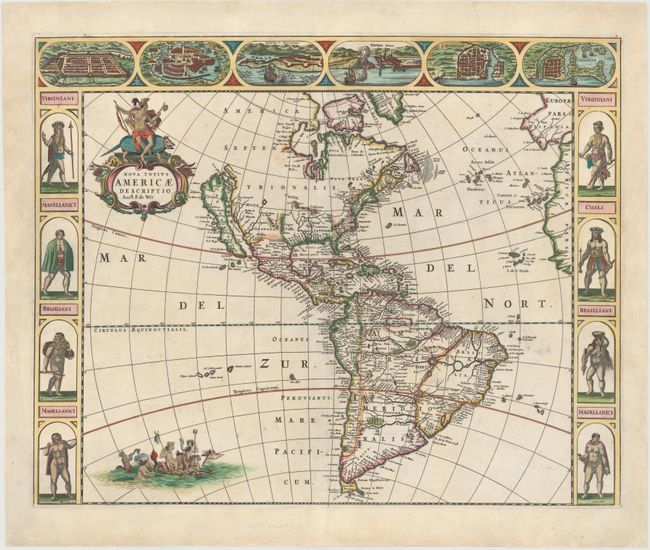
Auction 145, Lot 73
Subject: Western Hemisphere - America
Wit, Frederick de
Nova Totius Americae Descriptio, 1666
Size: 21.8 x 17.3 inches (55.4 x 43.9 cm)
Estimate: $4,750 - $6,000
Sold for: $3,500
Closed on 6/12/2013
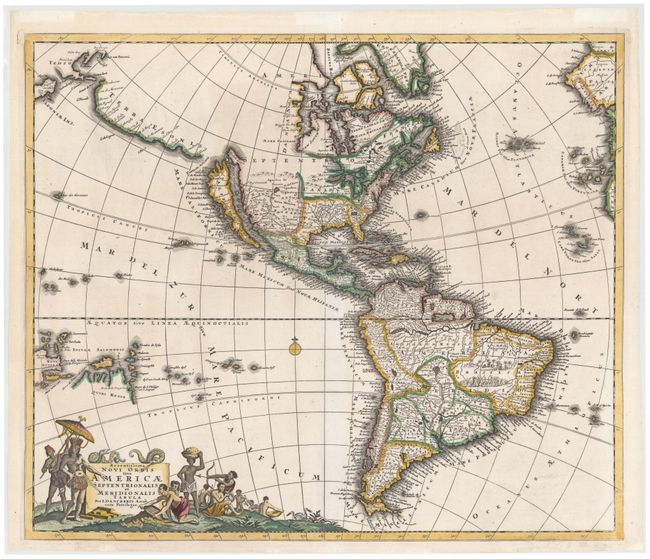
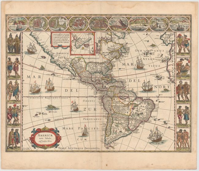
Auction 145, Lot 76
Subject: Western Hemisphere
Danckerts, Justus
Recentissima Novi Orbis sive Americae Septentrionalis et Meridionalis Tabula, 1696
Size: 23 x 19.5 inches (58.4 x 49.5 cm)
Estimate: $1,900 - $2,100
Unsold
Closed on 6/12/2013
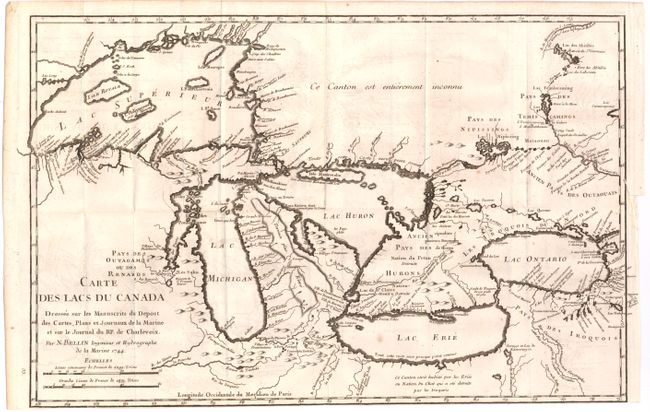
Auction 145, Lot 127
Subject: Colonial United States & Canada, Great Lakes
Bellin, Jacques Nicolas
Carte des Lacs du Canada…, 1744
Size: 17.2 x 11.2 inches (43.7 x 28.4 cm)
Estimate: $1,500 - $2,000
Bellin's Seminal Map of the Great Lakes
Sold for: $1,100
Closed on 6/12/2013
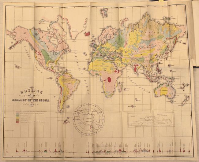
Auction 145, Lot 135
Subject: United States & Canada
Hitchcock, Edward
[Maps with Report] A Geological Map of the United States and Canada [and] Outline of the Geology of the Globe, 1853
Size: See Description
Estimate: $1,000 - $1,300
First Edition of Hitchcock's Important Maps and Report
Unsold
Closed on 6/12/2013
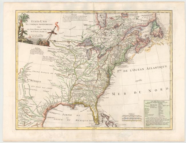
Auction 145, Lot 139
Subject: Eastern Canada & United States
Delamarche, Charles Francois
Etats-Unis de l'Amerique Septentrionale avec les Isles Royale, de Terre Neuve, de St. Jean, l'Acadie &c., 1785
Size: 24.6 x 18.7 inches (62.5 x 47.5 cm)
Estimate: $1,100 - $1,300
First Reference to Michigan as a Land Division of the US
Sold for: $650
Closed on 6/12/2013
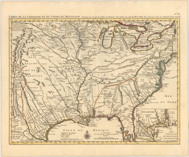
Auction 145, Lot 151
Subject: Colonial United States, Louisiana Territory
Delisle/Covens & Mortier
Carte de la Louisiane et du Cours du Mississipi Dressee sur un Grand Nombre de Memoires entr'autres sur ceux de Mr. le Maire, 1733
Size: 23.4 x 17.2 inches (59.4 x 43.7 cm)
Estimate: $3,000 - $3,750
Sold for: $2,750
Closed on 6/12/2013
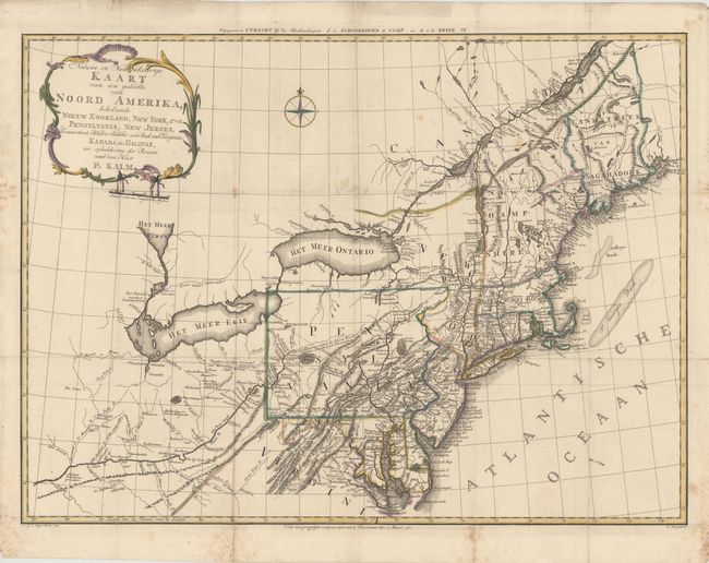
Auction 145, Lot 153
Subject: Colonial Northeastern United States
Kalm, Peter
Nieuwe en Nauwkeurige Kaart van een gedeelte van Noord Amerika, behelzende Nieuw Engeland, New York, Pensylvania, New Jersey, Connecticut, Rhode Island, een Stuk van Virginia, Kanada en Halifax, 1772
Size: 29.9 x 22 inches (75.9 x 55.9 cm)
Estimate: $1,600 - $2,000
Unsold
Closed on 6/12/2013
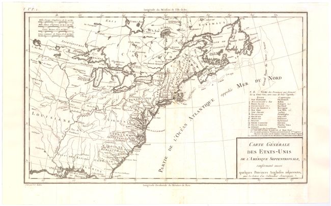
Auction 145, Lot 154
Subject: Eastern United States
Crevecoeur, Michel Guillaume De
Carte Generale des Etats-Unis de l'Amerique Septentrionale, Renfermant Aussi quelques Provinces Angloises adjacentes…, 1787
Size: 16.6 x 10 inches (42.2 x 25.4 cm)
Estimate: $350 - $450
First Printed Map to Name Franklinia
Sold for: $800
Closed on 6/12/2013
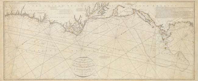
Auction 145, Lot 166
Subject: Eastern United States
Norie, John William
To the Independent Mariners of America, This Chart of their Coast from Savannah to Boston is most Respectfully Dedicated…, 1852
Size: 61 x 25.3 inches (154.9 x 64.3 cm)
Estimate: $2,400 - $3,000
Rare Blue-Back Chart of the East Coast
Unsold
Closed on 6/12/2013
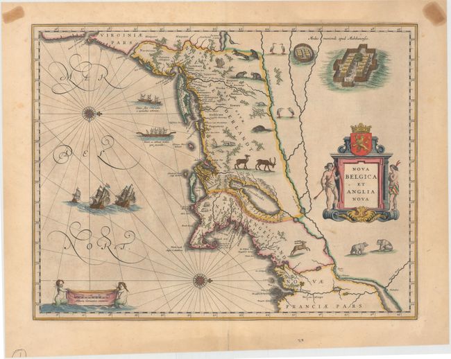
Auction 145, Lot 171
Subject: Colonial New England & Mid-Atlantic
Blaeu, Willem
Nova Belgica et Anglia Nova, 1650
Size: 19.9 x 15.2 inches (50.5 x 38.6 cm)
Estimate: $3,500 - $4,250
Important Map of Colonial New England and the Mid-Atlantic
Sold for: $2,500
Closed on 6/12/2013
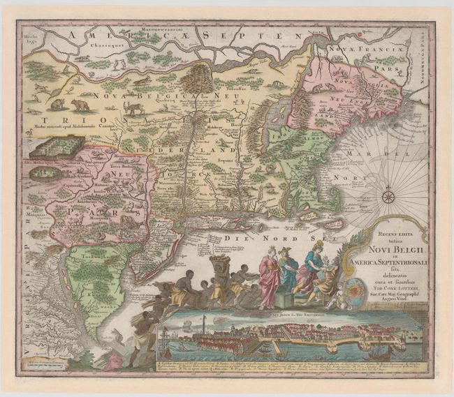
Auction 145, Lot 172
Subject: Colonial New England & Mid-Atlantic
Seutter/Lotter
Recens Edita Totius Novi Belgii, in America Septentrionali Siti, Delineatio Cura et Suntibus, 1760
Size: 22.9 x 19.7 inches (58.2 x 50 cm)
Estimate: $3,750 - $4,500
Sold for: $2,300
Closed on 6/12/2013
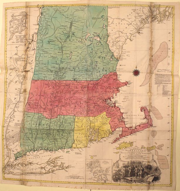
Auction 145, Lot 173
Subject: Colonial New England
Lotter, Tobias Conrad
A Map of the Most Inhabited Part of New England, Containing the Provinces of Massachusets Bay and New Hampshire, with the Colonies of Conecticut and Rhode Island…, 1776
Size: 38 x 40.2 inches (96.5 x 102.1 cm)
Estimate: $4,000 - $5,000
Unsold
Closed on 6/12/2013
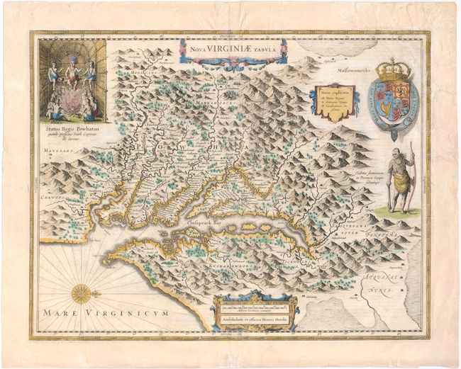
Auction 145, Lot 180
Subject: Colonial Mid-Atlantic
Hondius, Henricus
Nova Virginiae Tabula, 1633
Size: 19.5 x 15 inches (49.5 x 38.1 cm)
Estimate: $2,000 - $2,200
One of the Most Important 17th Century Maps of the Chesapeake Bay
Sold for: $1,500
Closed on 6/12/2013
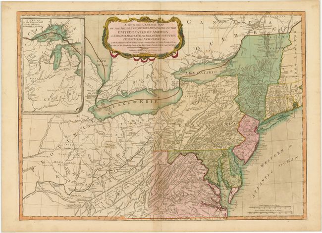
Auction 145, Lot 183
Subject: Mid-Atlantic United States & Great Lakes
Laurie & Whittle
A New and General Map of the Middle Dominions Belonging to the United States of America, viz. Virginia, Maryland, the Delaware-Counties, Pennsylvania, New Jersey &c. with the Addition of New York, & of the Greatest Part of New England…, 1794
Size: 26 x 18.8 inches (66 x 47.8 cm)
Estimate: $1,200 - $1,500
Laurie & Whittle's Popular Map Depicting the "New" United States
Sold for: $675
Closed on 6/12/2013
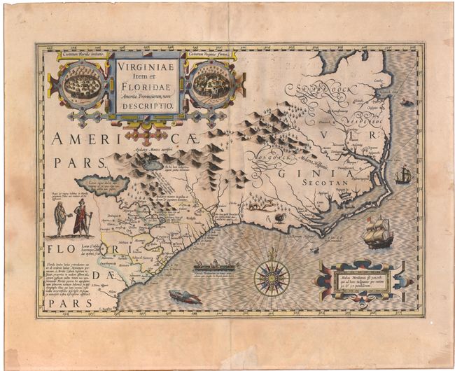
Auction 145, Lot 186
Subject: Colonial Southeast
Hondius, Jodocus
Virginiae item et Floridae Americae Provinciarum, Nova Descriptio, 1609
Size: 19 x 13.4 inches (48.3 x 34 cm)
Estimate: $1,900 - $2,200
A Seminal Map of the Southeast and Early American Cartography
Unsold
Closed on 6/12/2013
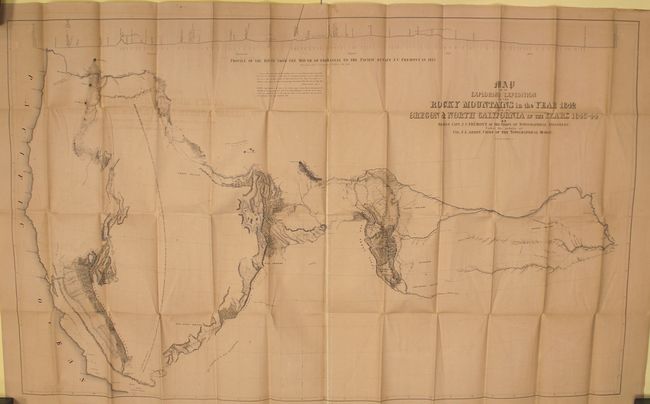
Auction 145, Lot 215
Subject: Western United States
Fremont/Preuss
Map of an Exploring Expedition to the Rocky Mountains in the Year 1842 and to Oregon & North California in the Years 1843-44 [with] Report of The Exploring Expedition to the Rocky Mountains…, 1845
Size: 51 x 30.5 inches (129.5 x 77.5 cm)
Estimate: $2,000 - $2,500
Sold for: $1,300
Closed on 6/12/2013
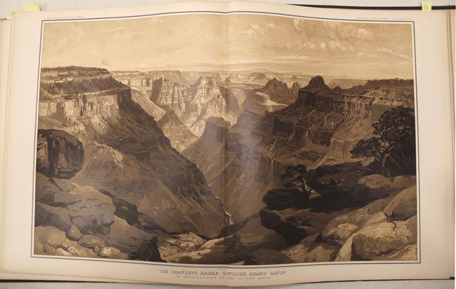
Auction 145, Lot 231
Subject: Grand Canyon, Arizona
Dutton, Clarence Edward
Atlas to Accompany the Monograph on the Tertiary History of the Grand Canon District, 1882
Size: 18 x 20.3 inches (45.7 x 51.6 cm)
Estimate: $4,000 - $5,000
Dutton's Famous Atlas of the Grand Canyon
Sold for: $2,500
Closed on 6/12/2013
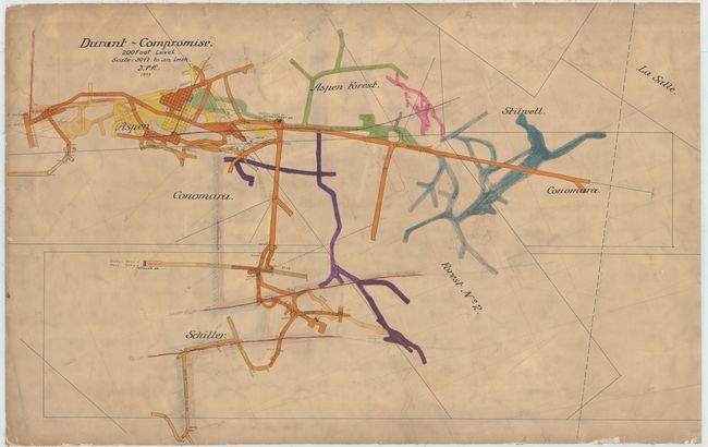
Auction 145, Lot 241
Subject: Aspen, Colorado
Anon.
[Manuscript Mining Map] Durant - Compromise, 1897
Size: 40.1 x 25.6 inches (101.9 x 65 cm)
Estimate: $1,200 - $1,500
Manuscript Silver Mining Map
Sold for: $1,000
Closed on 6/12/2013
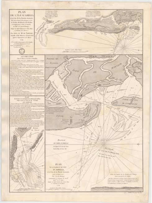
Auction 145, Lot 246
Subject: Florida
Depot de la Marine
Plan de l'Ile d'Amelia... [on sheet with] Plan de la Barre et du Port d'Amelia... [and] Plan de la Barre et de l'entree de la Riviere de Nassau, 1779
Size: 17.3 x 23.2 inches (43.9 x 58.9 cm)
Estimate: $1,000 - $1,200
Issued for Use by the French Navy during the American Revolution
Sold for: $650
Closed on 6/12/2013
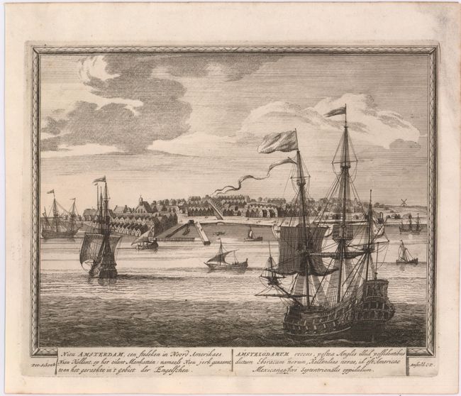
Auction 145, Lot 276
Subject: New York City, New York
Schenk, Pieter
Nieu Amsterdam, een Stedeken in Noord Amerikaes... / Amstelodamum Recens, Postea Anglis Illud Possidentibus..., 1702
Size: 10.3 x 8.5 inches (26.2 x 21.6 cm)
Estimate: $4,000 - $5,000
Rare Early View of New York City
Sold for: $2,500
Closed on 6/12/2013
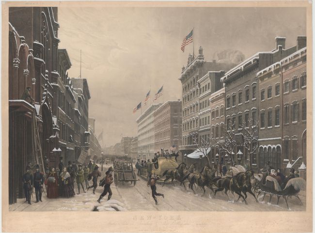
Auction 145, Lot 278
Subject: New York City, New York
Sebron, H.
New-York Winter Scene in Broadway / Scene d'Hiver dans Broadway, 1857
Size: 34 x 23.5 inches (86.4 x 59.7 cm)
Estimate: $2,000 - $2,300
Charming Scene of Broadway in Winter
Unsold
Closed on 6/12/2013
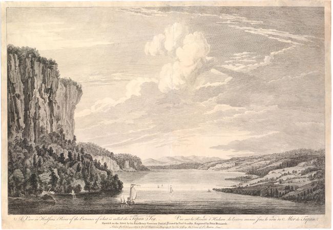
Auction 145, Lot 280
Subject: Hudson River, New York
Pownall, Thomas
A View in Hudson's River of the Entrance of What Is Called the Topan Sea / Vue sur la Riviere d'Hudson, de l'Entrée Counue sous le Nom de Mer de Topan, 1761
Size: 20 x 13.1 inches (50.8 x 33.3 cm)
Estimate: $2,000 - $2,200
Sold for: $1,200
Closed on 6/12/2013
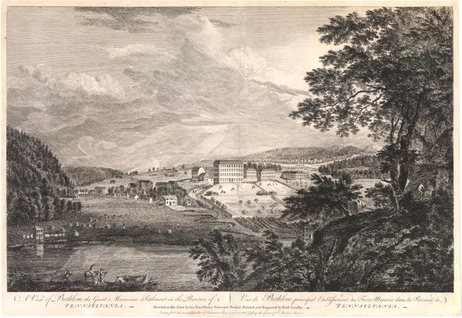
Auction 145, Lot 287
Subject: Bethlehem, Pennsylvania
Pownall, Thomas
A View of Bethlem, the Great Moravian Settlement in the Province of Pennsylvania / Vue de Bethlem, Principal Etablissement des Freres Moraves dans la Province de Pennsylvania, 1761
Size: 20.3 x 12.9 inches (51.6 x 32.8 cm)
Estimate: $2,000 - $2,200
Sold for: $1,200
Closed on 6/12/2013
Auction 145, Lot 293
Subject: South Carolina, Virginia
Ramsay, David
[2 Volumes] Histoire de la Revolution d'Amerique, par Rapport a la Caroline Meridionale…, 1787
Size: 5 x 8 inches (12.7 x 20.3 cm)
Estimate: $2,200 - $2,500
Sold for: $1,800
Closed on 6/12/2013
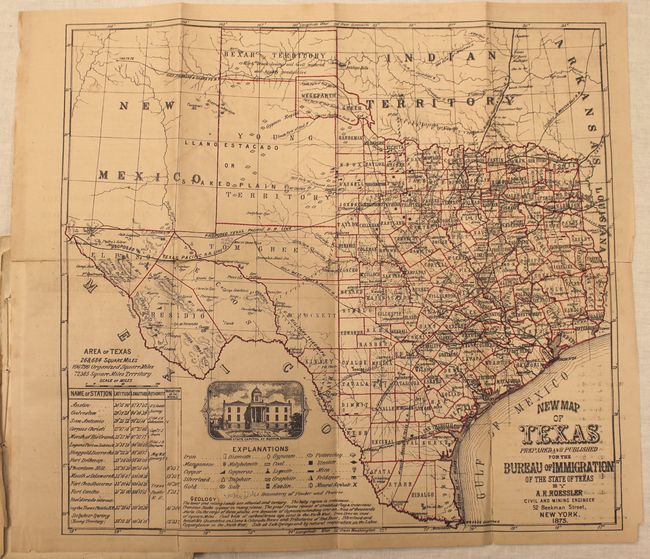
Auction 145, Lot 301
Subject: Texas
[Lot of 2] New Map of Texas [and] County and Railroad Map of Texas [in] Bryant's Railroad Guide, 1875
Size: 5.5 x 9.2 inches (14 x 23.4 cm)
Estimate: $2,500 - $3,250
Sold for: $2,000
Closed on 6/12/2013
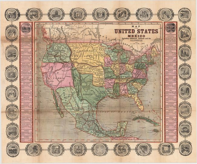
Auction 145, Lot 317
Subject: United States & Mexico
Haven, John
Map of the United States and Mexico Including Oregon, Texas and the Californias, 1846
Size: 15.3 x 14.3 inches (38.9 x 36.3 cm)
Estimate: $1,500 - $2,000
Unsold
Closed on 6/12/2013
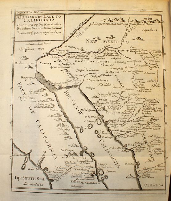
Auction 145, Lot 321
Subject: Southwestern United States & Mexico
Kino, Eusebio Francisco, SJ
A Passage by Land to California Discover'd by ye Rev. Fathr. Eusebius Francis Kino Jesuite between ye Years 1698 & 1701 [Map in The Philosophical Transactions…], 1721
Size: 7.5 x 9.3 inches (19.1 x 23.6 cm)
Estimate: $1,200 - $1,500
Father Kino's Important Map of California
Sold for: $600
Closed on 6/12/2013
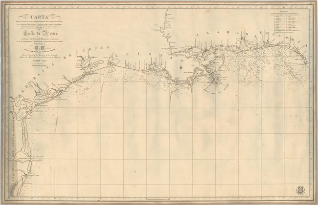
Auction 145, Lot 343
Subject: Gulf of Mexico, Republic of Texas
Direccion de Hidrografia
Carta de las Costas de la Escambia, Alabama y Bocas del Rio Misisipi, la Luisiana, Tejas, con la Provincia del Nuevo Santander en el Golfo de Mejico, 1846
Size: 38.2 x 24.6 inches (97 x 62.5 cm)
Estimate: $8,000 - $9,000
Unsold
Closed on 6/12/2013
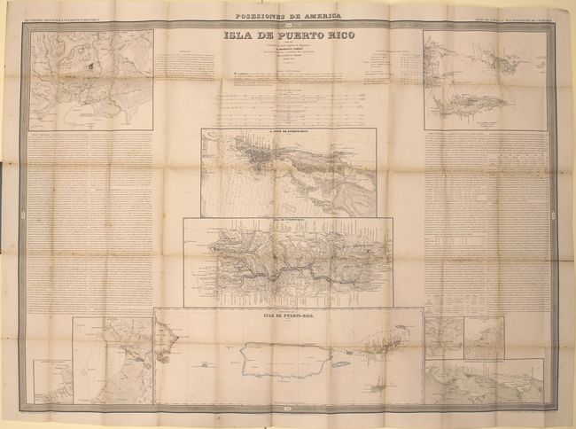
Auction 145, Lot 357
Subject: Puerto Rico
Coello y Quesada, Francisco
Isla de Puerto Rico, 1851
Size: 40.4 x 29.2 inches (102.6 x 74.2 cm)
Estimate: $1,600 - $2,000
Unsold
Closed on 6/12/2013
92 lots
Page 1 of 2