Showing Featured Lots(remove filter)
Filtered by Category:United States(Show All Categories)
Showing results for:Auction 110
Catalog Archive
11 lots
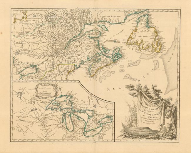
Auction 110, Lot 101
Subject: Colonial Great Lakes and Canada
Robert de Vaugondy
Partie de l'Amerique Septent? qui comprend la Nouvelle France ou le Canada, 1755
Size: 23.7 x 18.7 inches (60.2 x 47.5 cm)
Estimate: $750 - $900
Sold for: $800
Closed on 3/2/2005
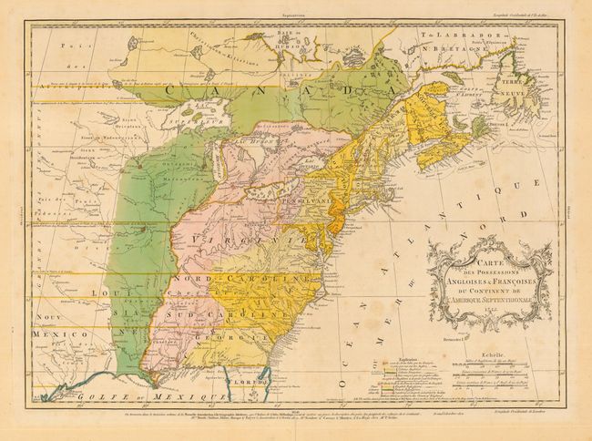
Auction 110, Lot 106
Subject: Colonial Canada and United States
Palairet, Jean
Carte des Possessions Angloises & Francoises du Continent de l'Amerique Septentrionale, 1755
Size: 22.7 x 16.2 inches (57.7 x 41.1 cm)
Estimate: $2,750 - $3,750
Sold for: $3,000
Closed on 3/2/2005
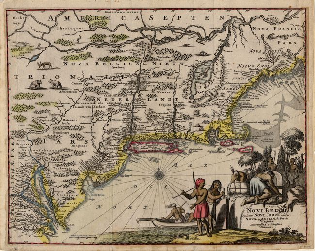
Auction 110, Lot 125
Subject: Colonial New England
Montanus, Arnoldus
Novi Belgii, quod nunc Novi Jorck Vocatur, Novae qz. Angliae & Partis Virginiae Accuratissima et Novissima Delineatio, 1671
Size: 14.5 x 11.5 inches (36.8 x 29.2 cm)
Estimate: $2,000 - $2,200
Sold for: $1,700
Closed on 3/2/2005
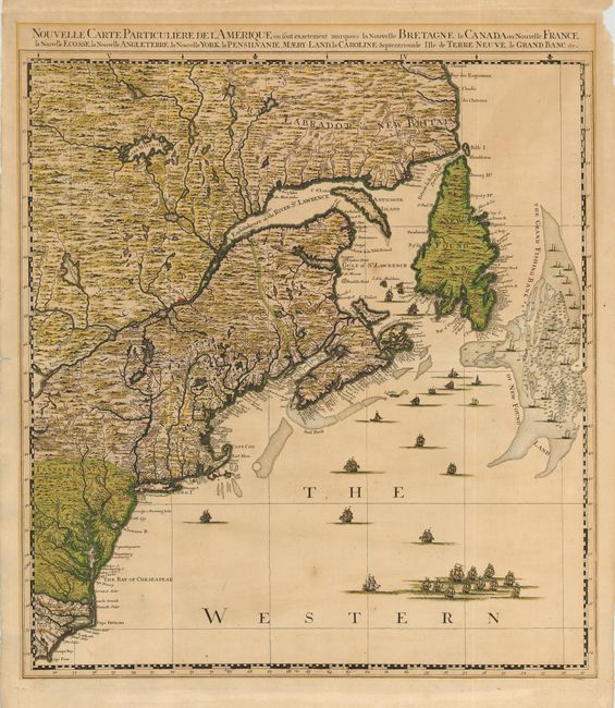
Auction 110, Lot 126
Subject: Colonial New England
Popple/Covens & Mortier
Nouvelle Carte Particuliere de l'Amerique ou sont exactement marquees la Nouvelle Bretagne, le Canada ou Nouvelle France, la Nouvelle Ecosse, la Nouvelle Angleterre, la Nouvelle York, la Pensilvanie, Maery-Land, la Caroline Septentrionale I' Ile de Terre, 1741
Size: 21 x 23.5 inches (53.3 x 59.7 cm)
Estimate: $3,000 - $3,500
Sold for: $3,250
Closed on 3/2/2005
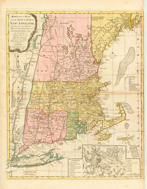
Auction 110, Lot 128
Subject: Colonial New England
Bowles, Carrington
Bowles's Map of the Seat of War in New England, Comprehending the Provinces of Massachusets Bay, and New Hampshire, with the Colonies or Connecticut and Rhode Island…, 1776
Size: 21 x 25 inches (53.3 x 63.5 cm)
Estimate: $3,000 - $4,000
Sold for: $3,000
Closed on 3/2/2005
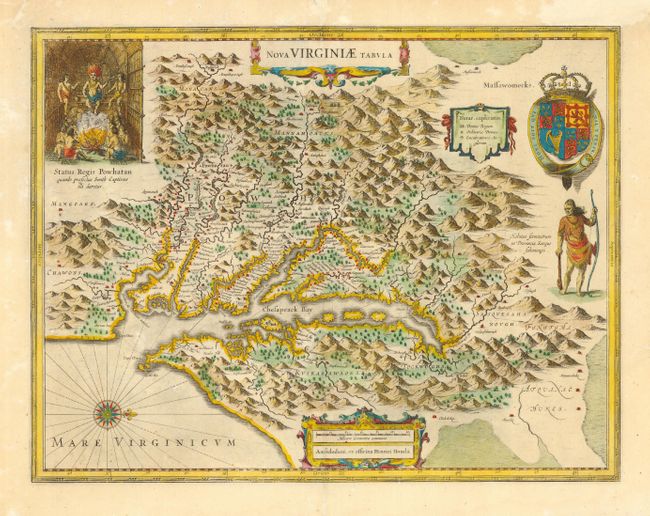
Auction 110, Lot 130
Subject: Colonial Mid Atlantic
Hondius, Henricus
Nova Virginiae Tabula, 1665
Size: 19.2 x 15 inches (48.8 x 38.1 cm)
Estimate: $2,300 - $2,750
Sold for: $1,700
Closed on 3/2/2005
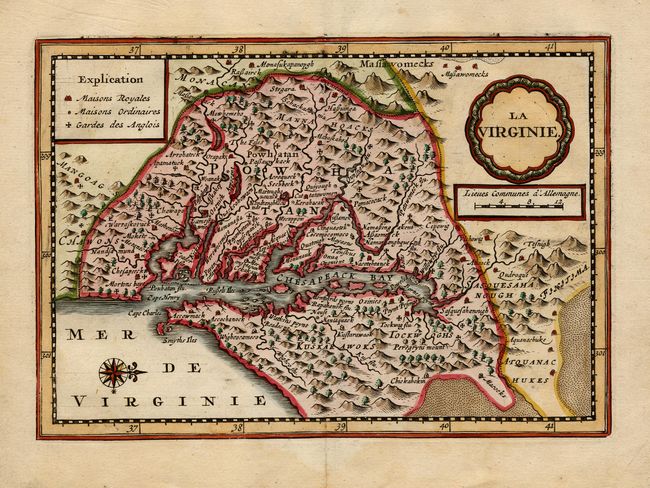
Auction 110, Lot 131
Subject: Colonial Mid Atlantic
Aa, Pieter van der
La Virginie, 1714
Size: 7.5 x 5.2 inches (19.1 x 13.2 cm)
Estimate: $1,100 - $1,300
Sold for: $3,750
Closed on 3/2/2005
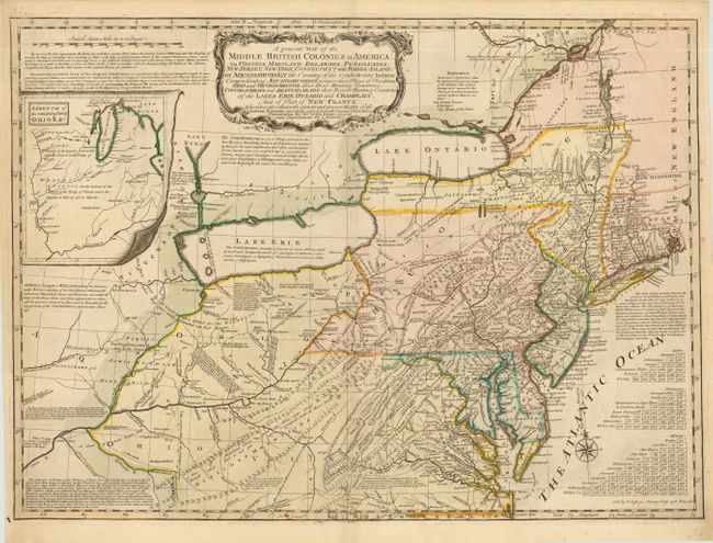
Auction 110, Lot 135
Subject: Colonial Mid Atlantic and Great Lakes
Evans/Jefferys
A general Map of the Middle British Colonies in America: viz. Virginia, Maryland, Delaware, Pensilvania, New Jersey, New York, Connecticut and Rhode-Island…, 1758
Size: 26.2 x 19 inches (66.5 x 48.3 cm)
Estimate: $5,000 - $6,000
Sold for: $6,500
Closed on 3/2/2005
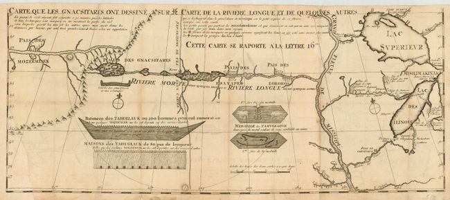
Auction 110, Lot 146
Subject: Colonial Midwest
Lahontan, Louis Armand
Carte que les Gnacsitares ont Dessine sur ... Carte de la Riviere Longue et de quelques Autres qui se Dechargent dans le Grand Fleuve Missisipi …, 1703
Size: 26.2 x 11 inches (66.5 x 27.9 cm)
Estimate: $700 - $800
Sold for: $700
Closed on 3/2/2005
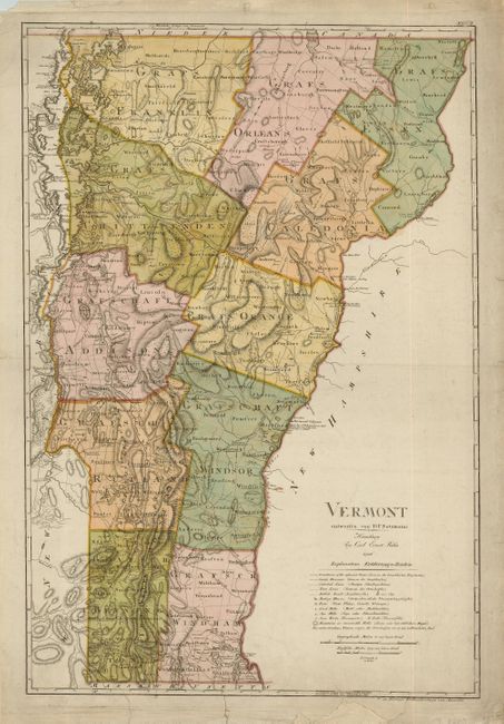
Auction 110, Lot 235
Subject: Vermont
Sotzmann, Daniel Friedrich
Vermont, 1796
Size: 18.2 x 27 inches (46.2 x 68.6 cm)
Estimate: $3,250 - $4,000
Sold for: $5,000
Closed on 3/2/2005
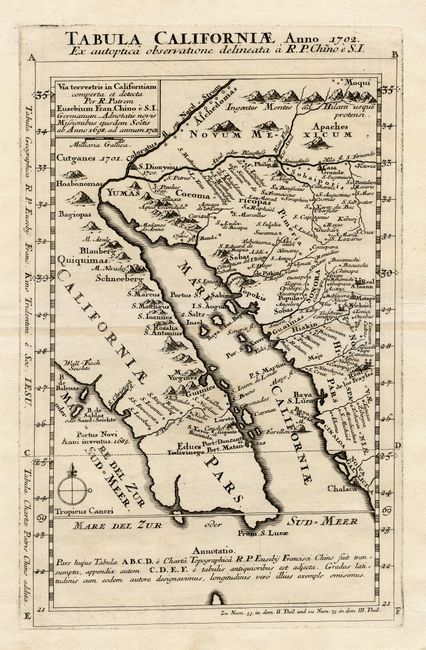
Auction 110, Lot 242
Subject: Colonial California and Mexico
Kino, Eusebio Francisco, SJ
Tabula Californiae Anno 1702 Ex autoptica observatione delineata a R.P. Chino e S.I., 1702
Size: 8.7 x 13.5 inches (22.1 x 34.3 cm)
Estimate: $1,900 - $2,200
Sold for: $1,400
Closed on 3/2/2005
11 lots