Showing Featured Lots(remove filter)
Filtered by Category:Latin America, Caribbean(Show All Categories)
Showing results for:Auction 159
Catalog Archive
4 lots
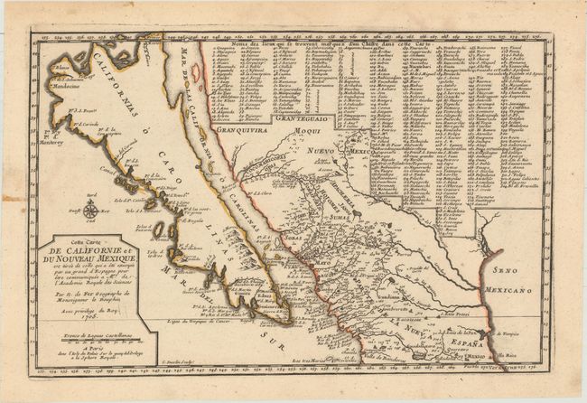
Auction 159, Lot 313
Subject: Southwestern United States & Mexico, California
Fer, Nicolas de
Cette Carte de Californie et du Nouveau Mexique, est Tiree de Celle qui a ete Envoyee par un Grand d'Espagne pour Etre Communiquee a Mrs. de l'Academie Royale des Sciences, 1705
Size: 13.4 x 8.9 inches (34 x 22.6 cm)
Estimate: $1,400 - $1,700
De Fer's Important Map of the Island of California
Unsold
Closed on 9/14/2016
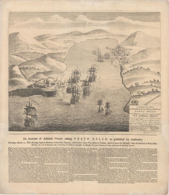
Auction 159, Lot 333
Subject: Portobelo, Panama
Bowles
A Perspective View of ye Harbour, Castles, & Town of Porto Bello: with ye Disposition of ye Ships Under ye Command of Vice Admiral Vernon..., 1740
Size: 19.2 x 15 inches (48.8 x 38.1 cm)
Estimate: $800 - $1,000
Scarce Broadside of Battle of Portobelo
Sold for: $700
Closed on 9/14/2016
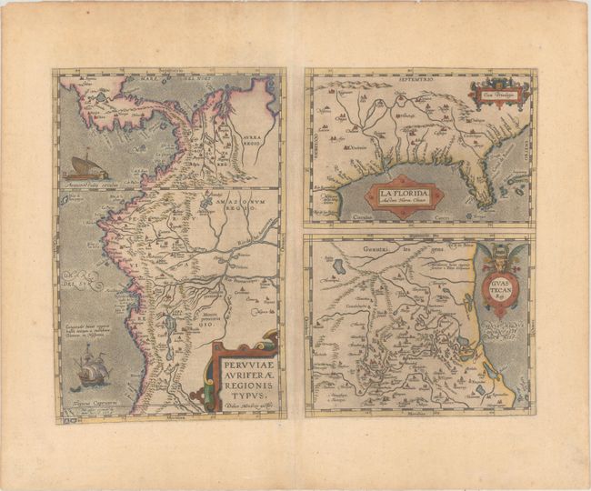
Auction 159, Lot 338
Subject: Gulf of Mexico, Florida & Peru
Ortelius, Abraham
Peruviae Auriferae Regionis Typus. Didaco Mendezio Auctore [on sheet with] La Florida. Auctore Hieron. Chiaves [and] Guastecan Reg., 1592
Size: 18.1 x 13.1 inches (46 x 33.3 cm)
Estimate: $1,300 - $1,600
The First Printed Map of the Southern United States
Unsold
Closed on 9/14/2016
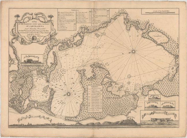
Auction 159, Lot 375
Subject: Cartagena Bay, Colombia
Durell, Philip
A Plan of the Harbour Town and Castles of Carthagena..., 1741
Size: 27.8 x 19.4 inches (70.6 x 49.3 cm)
Estimate: $1,400 - $1,800
Rare Chart Published Four Months After the Battle of Cartagena
Sold for: $4,000
Closed on 9/14/2016
4 lots