Showing Featured Lots(remove filter)
Filtered by Category:Latin America, Caribbean(Show All Categories)
Showing results for:Auction 155
Catalog Archive
5 lots
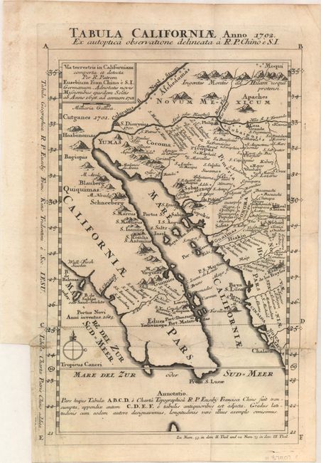
Auction 155, Lot 323
Subject: Southwestern United States & Mexico
Kino, Eusebio Francisco, SJ
Tabula Californiae, Anno 1702. Ex Autoptica Observatione Delineata a R.P. Chino e S.I., 1702
Size: 8.7 x 13.4 inches (22.1 x 34 cm)
Estimate: $1,600 - $2,000
NO RESERVE - Kino's Scarce Second Map of Lower California
Unsold
Closed on 11/18/2015
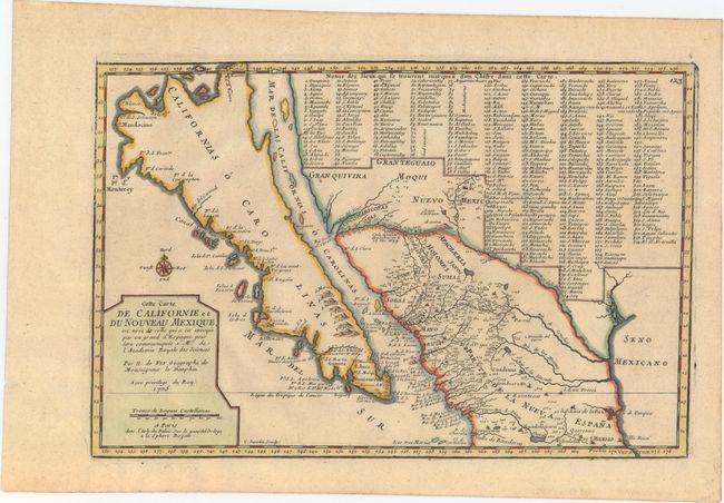
Auction 155, Lot 324
Subject: Southwestern United States & Mexico, California
Fer, Nicolas de
Cette Carte de Californie et du Nouveau Mexique, est Tiree de Celle qui a ete Envoyee par un Grand d'Espagne..., 1705
Size: 13.4 x 8.9 inches (34 x 22.6 cm)
Estimate: $1,200 - $1,500
De Fer's Important Map of the Island of California
Sold for: $900
Closed on 11/18/2015
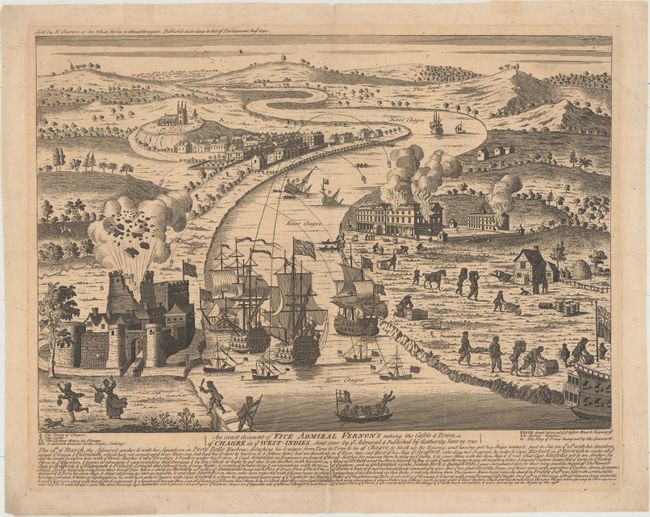
Auction 155, Lot 340
Subject: Chagres, Panama
Overton, Henry
An Exact Account of Vice Admiral Vernon's Taking the Castle & Town of Chagre in ye West-Indies, Sent Over by ye Admiral..., 1740
Size: 18.9 x 13.1 inches (48 x 33.3 cm)
Estimate: $2,000 - $2,300
Scarce View of Vernon's Capture of Fort San Lorenzo
Sold for: $1,500
Closed on 11/18/2015
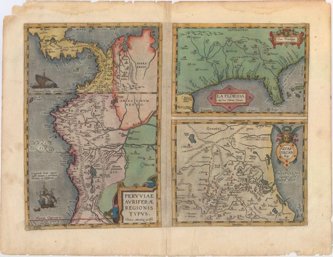
Auction 155, Lot 341
Subject: Gulf of Mexico, Florida & Peru
Ortelius, Abraham
Peruviae Auriferae Regionis Typus [on sheet with] La Florida [and] Guastecan, 1584
Size: 18.1 x 13.1 inches (46 x 33.3 cm)
Estimate: $1,300 - $1,600
The First Printed Map of the Southern United States
Sold for: $760
Closed on 11/18/2015
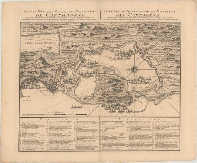
Auction 155, Lot 377
Subject: Cartagena, Colombia
Covens & Mortier
Plan du Port de la Ville, et des Forteresses de Carthagene... / Plan van de Haven, Stadt en Kasteelen van Cartagena..., 1741
Size: 22.4 x 17.8 inches (56.9 x 45.2 cm)
Estimate: $800 - $1,000
Scarce Plan of English Siege of Cartagena During War of Jenkins' Ear
Sold for: $550
Closed on 11/18/2015
5 lots