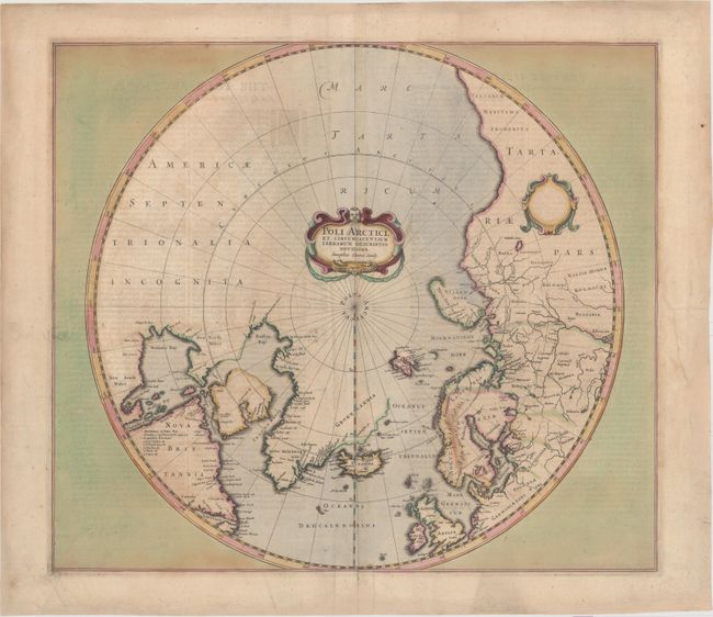
Early Edition - Rare Second Proof State
"Poli Arctici, et Circumiacentium Terrarum Descriptio Novissima", Hondius, Henricus
Subject: North Pole
Period: 1636 (published)
Publication: Atlas
Color: Hand Color
Size:
19.5 x 17.1 inches
49.5 x 43.4 cm
A very early edition of Hondius' important map of the polar region that replaced Mercator's polar map and incorporated much of the knowledge gained by the English in their search for a Northwest Passage to Asia. The North American cartography is based on Henry Briggs depiction of Hudson Bay. Numerous discoveries are shown including those of Frobisher, Davis, Baffin, Hudson, Button, Foxe, and James. There are several Dutch names in Labrador, many appearing for the first time on this map. English text on the verso describes the peoples, animals (including unicorns) and explorations of the North Pole. This is the second proof state, which is among the rarest states of this map according to Burden.
References: Burden #246; Kershaw #97; Van der Krogt (Vol. I) #0020:1B:1:341.
Condition: B+
Full original color with several small chips along the edges, a few short cracks, and a few edge tears that have all been professionally repaired. There is some minor soiling and light show-through of text on verso.