A Cataloger's Perspective: Mapping Asiaby Eliane Dotson
This article is the fourth in our series of mapping the world and continents from the perspective of a cataloger. If you missed our previous articles, you can read about mapping the World, North America Part I, and North America Part II in our newsletter archive. Our goal with this series is not to provide a comprehensive discussion, as there are entire reference books better suited to that purpose, but to offer a quick guideline of some of the key features to note on maps of the world and continents.
With the continent of Asia, just about every country and island underwent major changes in cartography between the 16th and 19th centuries. As most presently collectable maps of Asia were created by Europeans, they reflected European knowledge of the continent and extent of exploration at the time. Asia was believed to be a land of abundant and exotic riches, including spices and herbs, silks, drugs, precious metals, minerals, gems, and textiles. And it was these commercial interests that largely drove European explorations into Asia as they sought a way to circumvent the Arab middlemen who dominated the trade route between the East and West.
Although commerce was the driving force behind the voyages of discovery to the East, both Claudius Ptolemy and Marco Polo played a role in helping the Europeans understand what was possible. Marco Polo's travels to China in the 13th century showed that a trade route by sea was feasible and that middlemen could be avoided. Then the revival of Ptolemy's work in the 14th and 15th centuries advanced the geographical knowledge of the world and helped redefine cartography with a mathematical approach, further stimulating exploration. Because of errors in reports (including those from Polo and Ptolemy) the mapping of Asia did not progress smoothly, and a number of cartographic misrepresentations can be found. Below are some of the more notable ones. (If you click on any of the map images below, you can see the full map and read more about it.)
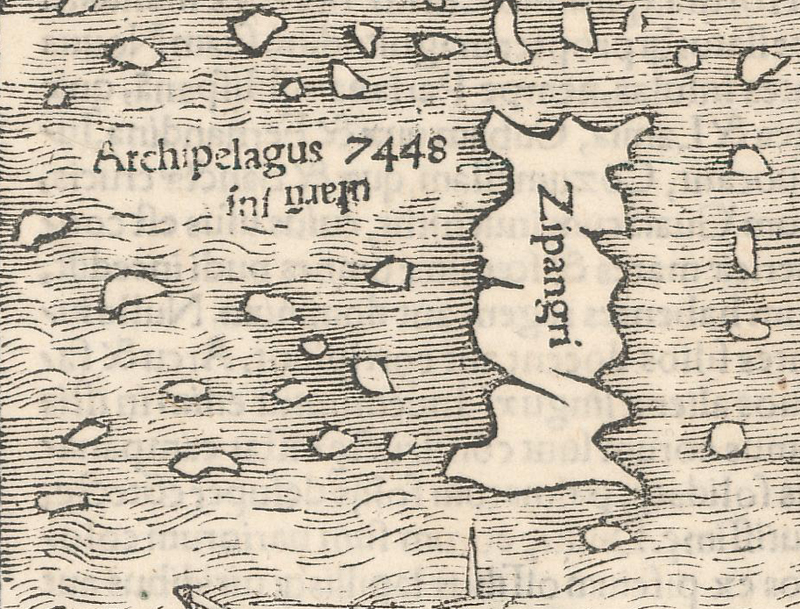
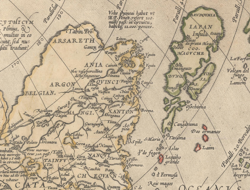
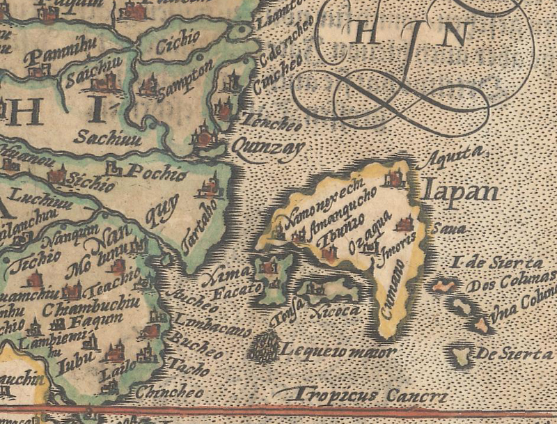
Japan The location, size, and shape of Japan changed numerous times based on various reports, both from first-hand visits and secondary sources. While the earliest printed maps of Asia, by Calius Julius Solinus and Sebastian Munster, completely omitted Japan, the first appearances of Japan on maps were based on Marco Polo's account. Polo's information came from Chinese sources, which placed Japan too far to the east in a north-south orientation, often a single island rectangular in shape, and with the name "Cipangu" or "Zipangu," derived from the Chinese term for the Kingdom of Japan. The Portuguese were the first Europeans to land in Japan in 1542 or 1543, and soon thereafter maps began to identify the country as "Iapan" or "Giapan," often still as a single island but typically in an east-west orientation. However, various cartographers (and sometimes even the same cartographer, such as with Abraham Ortelius) presented Japan in various shapes, including oval, round, and crescent-shaped. Many of the representations at this time were influenced by the work of Portuguese cartographers Luis Teixeira and Ignacio Moreira. Knowledge of the geography of Japan continued to improve with reports from both trade companies and religious orders, such as the Jesuits, with notable advances based on the work of Martino Martini, Engelbert Kaempfer, and others.
Because Munster estimated Japan too far east, it doesn't show on his map of Asia, but appears near the coast of North America on his map of the Western Hemisphere. Sebastian Munster, Novae Insulae XXVI Nova Tabula, 1552.
Ortelius' map of Asia with Japan shown far too north and in a strange kite shape. Abraham Ortelius, Asiae Nova Descriptio, 1571.
An interesting crescent-shaped Japan. Matthias von Kinckelbach Quad, Asia Partiu Orbis Maxima, 1598.
Japan is beginning to take shape, although Hokkaido does not yet appear. Jodocus Hondius, Asiae Nova Descriptio, 1613.
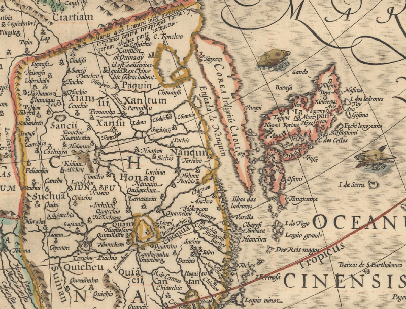
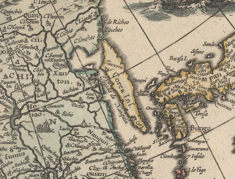
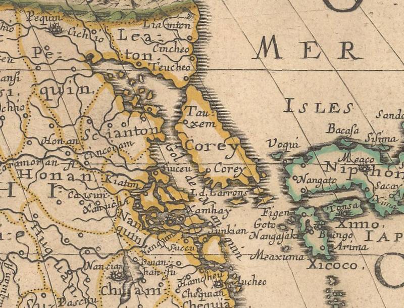
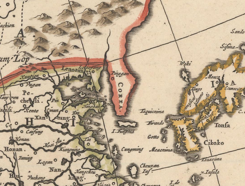
Korea as an Island While numerous European countries were establishing trading posts and missionaries throughout Asia, Korea remained inhospitable to foreigners. This resulted in a lack of geographic information and early maps of Asia omit the country. Once Korea began to appear on maps, it was shown alternately as a peninsula and an island. The misrepresentation of Korea as an island was possibly due to European exposure to Korean-made maps exaggerating the Yalu and Tumen Rivers to the north, or simply because of inaccurate reports. In the 1650s the myth of Korea as an island was dispelled based on new cartographic information from Jesuit Martino Martini and Hendrick Hamel, who was shipwrecked in South Korea with the Dutch East India Company and was taken captive. Further updates to the mapping of Korea did not occur until Jean Baptiste Bourguignon d'Anville's map of Korea was published in 1735, finally showing a correct outline for the country and more detail in the interior.
Ruscelli's map of Asia completely omits Korea. Girolamo Ruscelli, Asia, 1598.
Korea is an elongated island named "Corea Ins." Willem Blaeu, Asia Noviter Delineata, 1618.
Korea is still an island, but in a trapezoidal shape. Sanson/Mariette, Asia, 1650.
Korea is definitively shown as a peninsula, although the shape is still rudimentary. Frederick de Wit, Asiae Nova Descriptio, 1660.
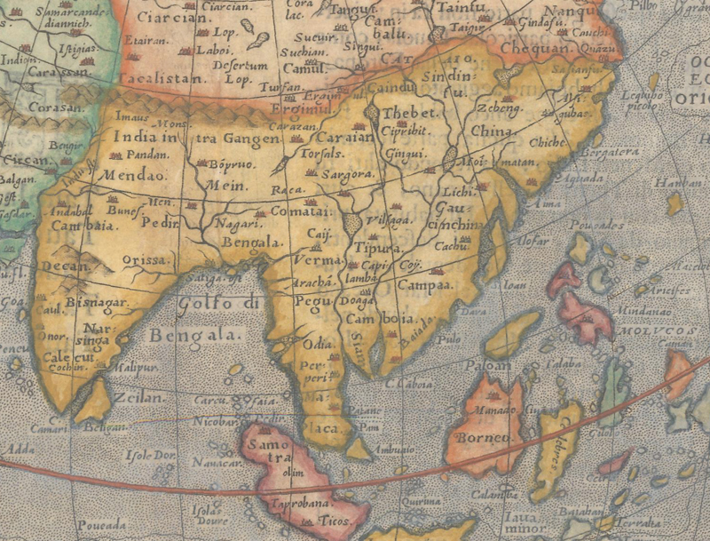
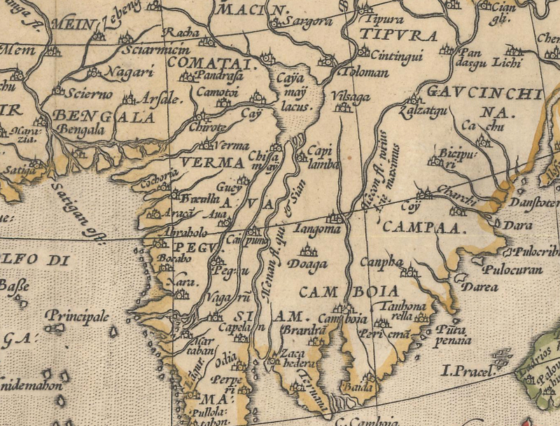
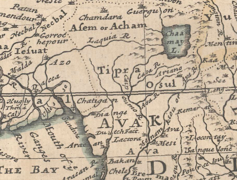
Chiamay Lacus According to Hindu and Buddhist mythology, Mount Sumeru (or Meru) is considered the center of the universe, and at the foot of this mountain is a lake with several rivers flowing out of it. Marco Polo made note of this lake in his account, and it began appearing on maps of Asia beginning with Ortelius' Asiae Nova Descriptio in 1570. The lake was labeled "Cayamay" on Ortelius' map, and later evolved into "Chyamai," "Chiamay," and other variations on maps by other cartographers. The lake is typically located to the north of Burma and Thailand with 3 to 6 rivers flowing south into the Gulf of Thailand, the Bay of Bengal, or both. The lake and its rivers appeared on maps for over 250 years until finally being dispelled after the sources of the major rivers in Indo-China were properly established.
The first map of Asia on which "Cayamay Lacus" appears. Abraham Ortelius, Asiae Nova Descriptio, 1571.
Here four rivers flow from "Chaamay L." Herman Moll, To the Right Honourable William Lord Cowper...This Map of Asia..., 1730.
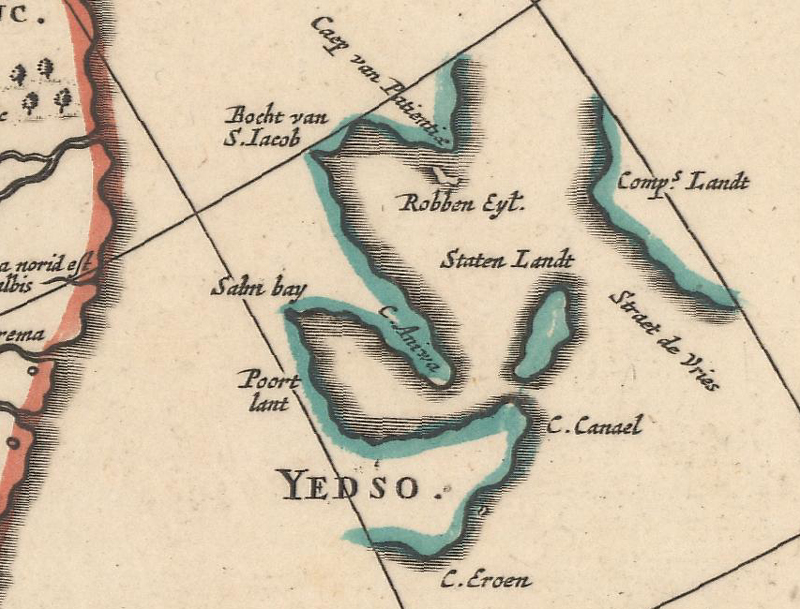
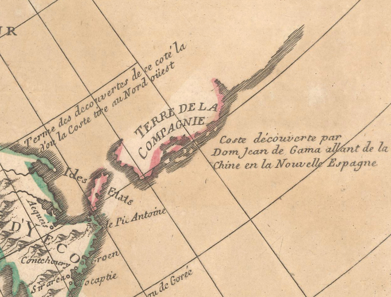
Staten Island & Company Land In 1643 Maarten Gerritsz de Vries was commissioned by the Dutch East India Company to explore the northwestern Pacific Ocean north of Japan. After passing Honshu and continuing along the east coast of Hokkaido, Vries encountered fog and had to keep his ship well away from the coastline as he continued northeast. As he reached the southern Kuril Islands, he named one of the islands "Staten Eylandt" and after making brief landfall even further, named that land "Compagnijs Landt" after the Dutch East India Company. Staten Island and an undefined Company Land made their first appearances on Johannes Blaeu's double-hemisphere world map in 1658 and Frederick de Wit's 1661 map of Asia. Although the amorphous Company Land was initially depicted as a short stretch of coastline, it gradually increased in size until it stretched all the way across the Pacific, nearly reaching North America. This stretch of land was also sometimes attributed to the explorations of Joao da Gama, who in 1589-90 sighted land northeast of Japan while traversing the Pacific Ocean on his way to Mexico. It is unknown exactly where De Gama sighted the land and how long the coastline was, thereby becoming a point of speculation for cartographers, appearing on maps even after Vitus Bering's expeditions in the North Pacific between 1727-43.
One of the first appearances of "Staten Landt" and "Comp.s Landt," shown northeast of "Yedso" (Hokkaido).Frederick de Wit, Asiae Nova Descriptio, 1660.
Here Staten Island is named "Ides Etats" and a note about Da Gama's discovery appears adjacent to "Terre de la Compagnie." Guillaume Delisle, L'Asie Dressee sur les Observations de l'Academie Royale des Sciences..., 1700.
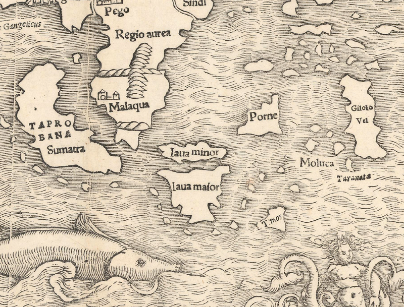
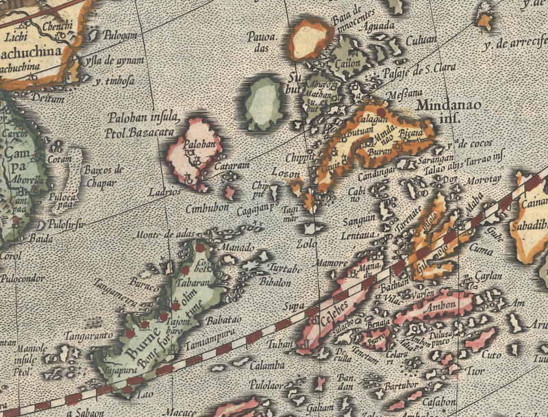
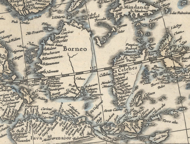
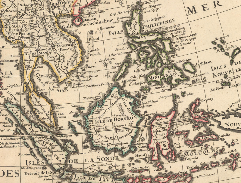
East Indies Due primarily to the lucrative spice trade, exploring the East Indies and establishing trade routes and ports were key goals for the Portuguese, Spanish, Dutch, and English. The region represented a confusing maze of thousands of islands, straits, and seas, and geographical knowledge of the region progressed in line with the importance of each island to the European trade market. Early printed maps of Asia included only the larger islands within the East Indies, depicted with rudimentary outlines and often changing names. Early on Sumatra was labeled Taprobana, mistaken for Ceylan, and a very rotund Java was known as Java Major with a neighboring island (alternately to the north and east) called Java Minor. As the Portuguese dominated the Moluccas, the Spanish focused their efforts on the Philippines. The European discovery of the Philippines is attributed to Ferdinand Magellan's expedition in 1521. Magellan named the group of islands St. Lazarus Islands, and the name was changed to the Philippines in 1543 in honor of the future King of Spain, Philip II. The shape of Borneo alternated between round and elongated versions until settling into its now familiar form in the early 18th century. Sulawesi (Celebes), with its complicated peninsulas and gulfs was difficult for navigators, and therefore took longer to map than other islands in the East Indies.
Sumatra is also labeled "Taprobana" and is west of the Malay Peninsula and Java Minor is north of an odd-shaped Java Maior. Sebastian Munster, Tavola della Oriental Regione dell' Asia, 1558.
Both Borneo and Celebes are elongated islands oriented diagonally and the Philippines are oddly shaped. Gerard Mercator, Asia ex Magna Orbis Terre Descriptione, 1619.
Portions of the coastlines of Borneo, Java, and Celebes are shown as conjectural. Hondius/Jansson, Asia Recens Summa Cura Delineata, 1652.
Most of the large islands are fairly well formed, with the exception of Celebes. Guillaume Delisle, Carte d'Asia Dressee pour l'Usage du Roy, 1723.
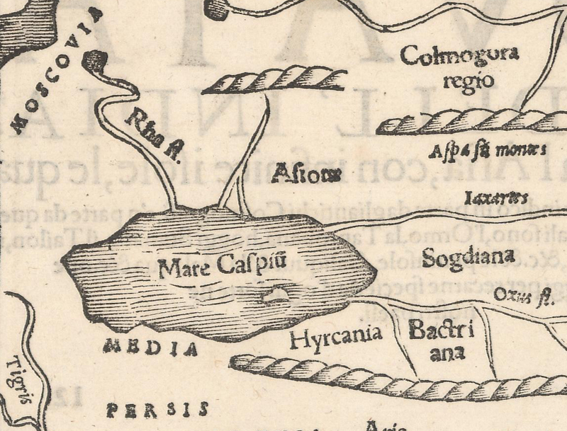
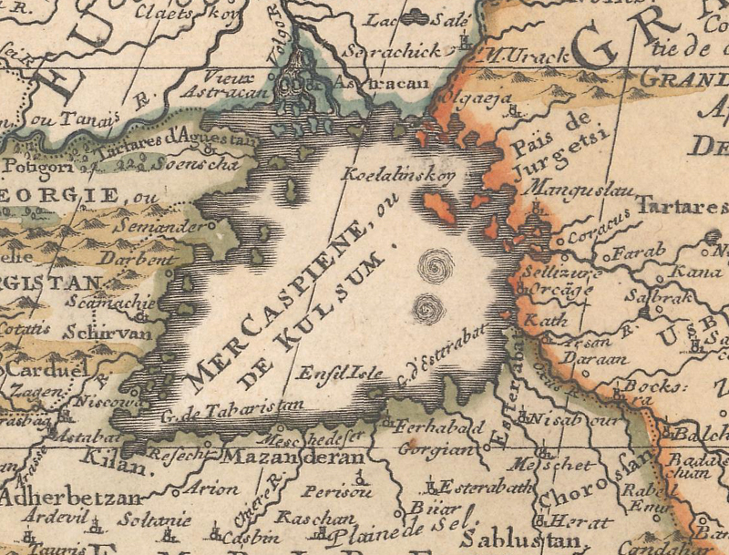
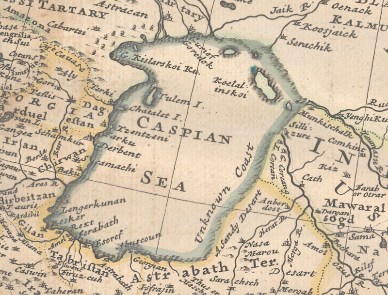
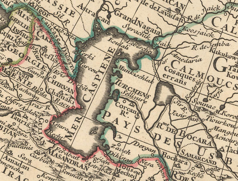
Caspian Sea Although relatively close to Europe, the Caspian Sea wasn't properly depicted on European maps until the early 18th century. The first maps of Asia in the 16th century oriented the Caspian Sea east-west in an oval shape, which can be seen on maps by Munster, Ortelius, Ruscelli, and Mercator. This depiction continued through around 1650, when the shape and orientation of the Caspian began to change dramatically from one cartographer to the next. On some maps it appeared quite round, while on other maps it shifted diagonally, either northwest to southeast or northeast to southwest. Others correctly reoriented the sea north-south, beginning in a triangular shape, a kidney bean, and finally shifting to a rectangle. Several maps of the early 18th century, including those by Moll and Chatelain, indicated that the eastern coast of the Caspian Sea was still "unknown." Zurner's map of Asia circa 1719 represented the first big advance in the depiction of the Caspian Sea, with the addition of the Caspian Depression in the north and the Kara Bogaz Gol Bay in the east. Soon thereafter, Delisle incorporated further improvements to the coastlines of the sea on his 1723 map of Asia, rendering the Caspian Sea in the familiar shape known today.
A very rudimentary, oval-shaped Caspian Sea oriented east-west. Sebastian Munster, Tavola della Oriental Regione dell' Asia, 1558.
This representation is oriented diagonally, and shows two whirlpools on the eastern side of the sea. Nicolas de Fer, L'Asie Dressee Selon les Dernieres Relations..., 1705.
Moll's Caspian Sea is properly oriented north-south, although much too wide and "unknown coast" noted along the eastern shore. Herman Moll, To the Right Honourable William Lord Cowper...This Map of Asia..., 1730.
Delisle's representation of the Caspian Sea finally showed a correct outline. Guillaume Delisle, Carte d'Asia Dressee pour l'Usage du Roy, 1723.
Looking Ahead Of course close inspection of maps of Asia over the centuries will elucidate many other interesting geographical representations, including India, Sri Lanka, the Malay Peninsula, Arabia, China, and more. It is always fascinating to note how geographical knowledge progressed (and sometimes regressed) over time.
Stay tuned next month for an article about the mapping of Europe!
References
Baynton-Williams, Ashley, "Korea as an Island," MapForum, Issue 8, London, 2005.
Davison, Dr. Julian & Tan Lay Kee, Mapping the Continent of Asia, Antiques of the Orient Pte. Ltd., Singapore, 1994.
Fell, R. T., Early Map of South-East Asia, Oxford University Press, Singapore, 1988.
Hubbard, Jason C., Japoniae Insulae The Mapping of Japan, Hes & de Graaf Publishers BV, Houten, Netherlands, 2012.
Kazutaka, Unno, "European Cartography of Korea in the Sixteenth and Seventeenth Centuries," Journal of the Korean History of Science Society, Vol. 9, No. 1, Seoul, Korea, 1987.
Lutz, Walter, Japan A Cartographic Vision, Prestel-Verlag, Munich, 1994.
Parry, Dr. David E., The Cartography of the East Indian Islands, Countrywide Editions, London, 2005.
Suarez, Thomas, Early Mapping of Southeast Asia, Periplus Editions Ltd., Singapore, 1999.