A Cataloger's Perspective: Mapping North America Part I
A Cataloger's Perspective: Mapping North America Part Iby Jon Dotson
This is the second article in our series that is intended to provide readers with a list of key features that we look for when cataloging maps for auction. As the first article focused on the world and shape of the continents, this and subsequent articles are primarily focused on internal features. As most of the maps listed in our auction are from the late 16th-19th century, our topics also focus on this time frame. Given the vast number of subjects that could be covered, this article should be considered a representative sampling only.
This North America article is divided into two parts. This current installment covers up to the late 18th century, while the second installment, covering late 18th-19th century, will be in the May newsletter.
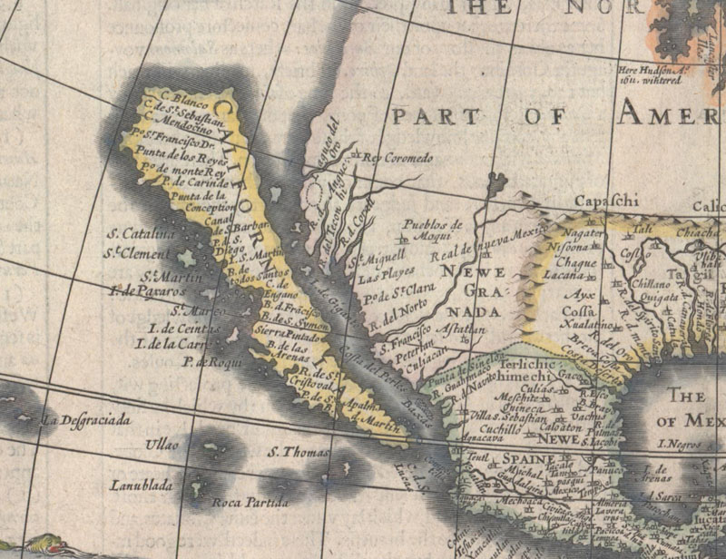
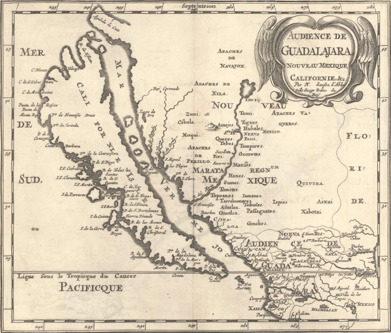
California as an Island (1622-1780s) One of the most notable and popular cartographic misconceptions to consider in North America is the depiction of California as an island. Caught somewhere between myth and mistake, this concept was introduced in the early 17th century and lasted for almost 200 years. There are three variations of insular California presented on maps. The first version presents a flat northern coastline and appears in maps by Abraham Goos (1624), Henry Briggs (1625), and John Speed (1626). This model continued until Nicolas Sanson published his Audience de Guadalajara, Nouveau Mexique, Californie in 1657 when the island was presented with an intended northern coastline based upon the the findings of English explorer Luke Fox. A third and final variant appears on George Matthaus Seutter's Nov. Orbis sive America Septentrionalis in 1740. On this map the island is very narrow in the center, almost becoming two islands. This portrayal reflects the theory of Father Luis Velarde, another Jesuit missionary who theorized that California was two islands after questioning natives about the geography of the region.
It is important to note that Father Eusebio Kino's map of 1705 entitled Passage par Terre a la Californie disproved the notion that California was an island, but it took another century for this concept to disappear from maps.
First version with a flat northern coastline. John Speed, America with Those Known Parts..., 1626.
Second version with an intended northern coastline. Nicolas Sanson, Audience de Guadalajara, Nouveau Mexique, Californie, 1683.
Third version with a narrow center. Matthias Seutter, Nova Orbis sive America Septentrionalis..., 1744.
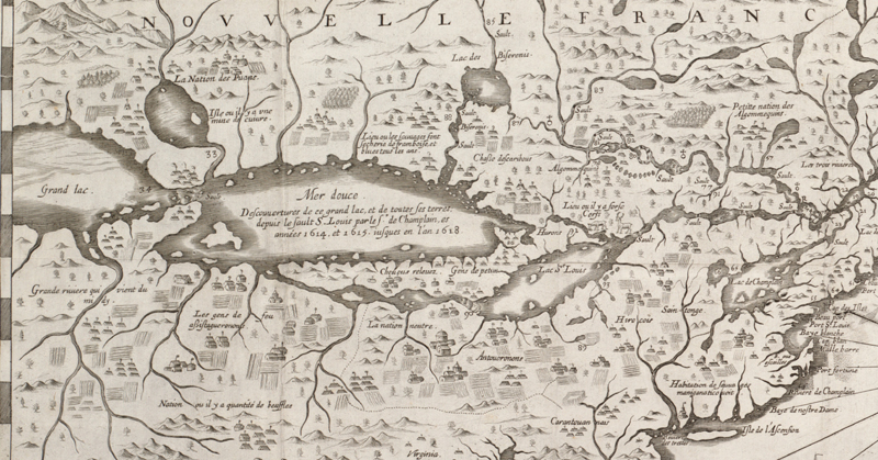
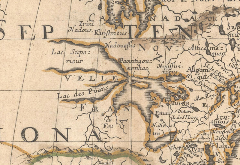
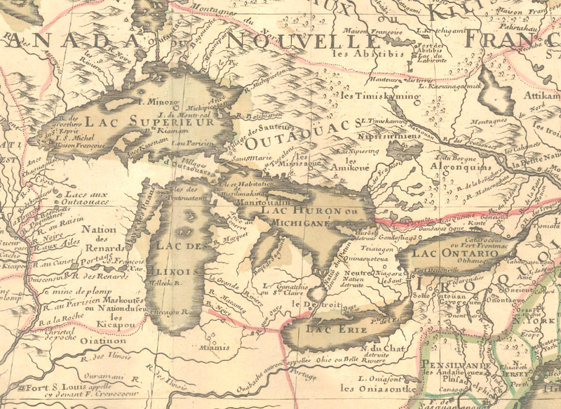
Great Lakes (1612-1760) The development of the Great Lakes region was an important aspect of the 17th century mapping of North America. Samuel de Champlain produced the first maps of the area in 1612, and his map of 1632 was the first to depict the entire Great Lakes network in rudimentary form. It wasn't until Nicolas Sanson's map of 1650, Le Canada, ou Nouvelle France, &c., that all five lakes were both depicted and named (although Michigan and Superior were left open ended). As the French continued to explore these regions in the latter 17th century, the accuracy of the Great Lakes mapping improved as well. This culminated in 1703 with Guillaume Delisle's Carte du Canada ou de la Nouvelle France that accurately portrayed both the shape and location of the Great Lakes for the first time. The majority of maps of this region are from French source and many follow Delisle's foundation map including Van der Aa, Covens & Mortier, and Buache to name a few. Not all cartographers were quick to adopt Delisle's model and many 18th century maps were inaccurately depicted. However, at the onset of the French & Indian War, considerably more attention was paid to this region by both French and British mapmakers.
The first map to depict the entire Great Lakes network. Samuel de Champlain, Carte de la Nouuelle France..., 1632. (Map reproduction courtesy of the Norman B. Leventhal Map & Education Center at the Boston Public Library)
The first map to both name and depict the Great Lakes. Nicolas Sanson, Le Canada, ou Nouvelle France, &c., Californie, 1650.
The first map to both accurately shape and locate the Great Lakes. Guillaume Delisle, Carte du Canada ou de la Nouvelle France..., 1703.
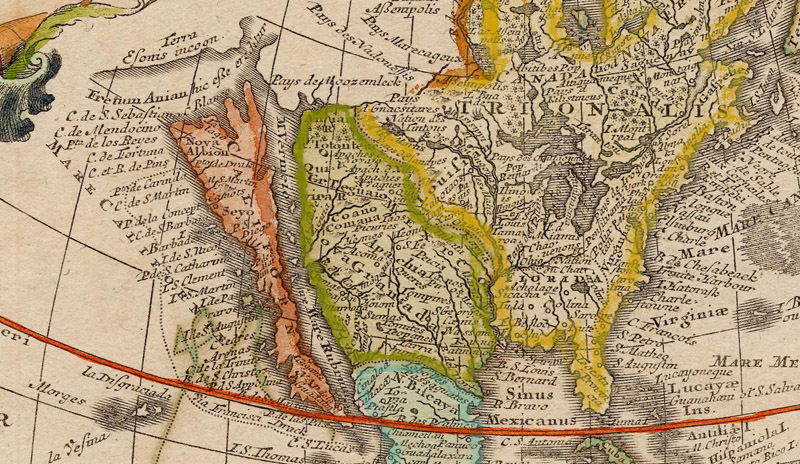
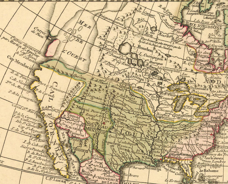
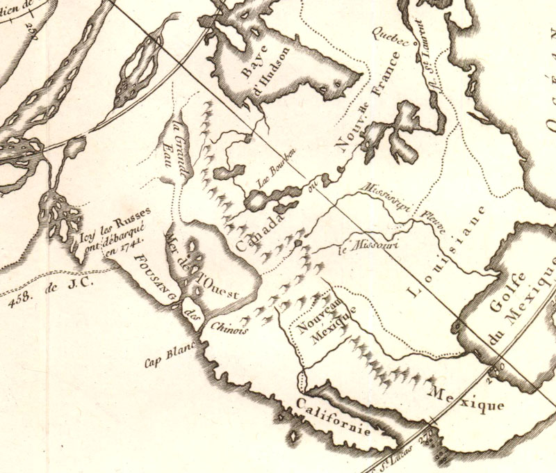
Sea of the West (1700-1810) Shortly after the European discovery of North America, there were various forms of speculation about a combination of lakes and rivers that might offer a passage from Europe to Asia. One of the most popular and enduring speculations was the Mer de l’Ouest or Sea of the West. Located on the western coast of North America, this sea first appeared in manuscript by Guillaume Delisle in 1695 and was copied in printed form by both Jean Baptiste Nolin and Pierre Mortier in 1700. While Delisle successfully sued Nolin for infringement and took his maps off the market, Mortier's map continued to circulate and was replicated by others in various size and shape. A later version of this sea would appear in 1750 by Philippe Buache and Joseph Nicolas Delisle (Guillaume’s half-brother) who revived the myth after the supposed accounts of Admiral de Fonte, in which he reportedly encountered a ship from Hudson's Bay after an inland journey via a series of bays and rivers. The notion of a Sea of the West would endure on some maps as late as the early 19th century.
An early, large appearance of the Sea of the West. Covens & Mortier, Carte d'Amerique Dressee pour l'Usage du Roy…, 1755.
A later version of the Sea of the West incorporating the accounts of Admiral de Fonte. Philip Buache, Carte des Terres Nouvellement Connues au Nord de la Mer du Sud..., 1761.
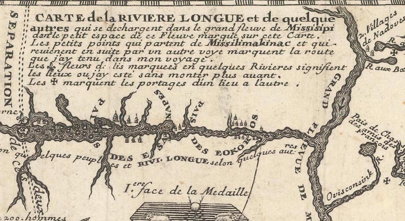
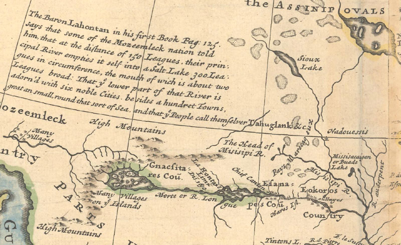
River Longue (1703-1780) Louis Armand, Baron de Lahontan served ten years in the French military in Canada, and traveled extensively in the Wisconsin and Minnesota region and the upper Mississippi Valley. Upon his return to Europe he wrote his enormously popular travelogue, Nouveaux Voyages de M. le Baron de Lahontan dans l'Amerique Septentrionale. In it he embellished his knowledge of the geography of the Great Lakes region, and the River Longue, which he claimed extended from the Mississippi River to the home of the Gnacsitares Indians in the Rocky Mountains. Over 20 editions of his book were published in four languages between 1703-1741, and resulted in his distorted cartography being accepted by several eminent cartographers who incorporated the "Lahontan" concept including Moll, Senex, Popple, and Delisle among many others. The River Longue can be found in maps as late as the 1780s.
Lahontan's fabricated River Longue. Louis Armand, Baron de Lahontan, Carte que les Gnacsitares ont Dessine... / Carte de la Riviere Longue..., 1703.
Lahontan's concept makes an appearance on Moll's large map of North America. Herman Moll, To The Right Honourable John Lord Sommers... This Map of North America According to ye Newest and Most Exact Observations, 1720.
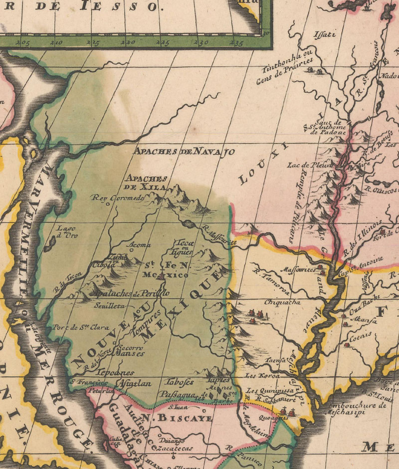
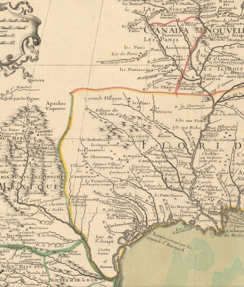
Mighty Interior Rivers (17th-18th Century) The paths of both the Rio Grande and Mississippi River are important features on maps of North America. Generally speaking, maps issued prior to about 1700 erroneously depicted the flow of these rivers. The Rio Grande was usually shown originating from a large western lake (or "parts unknown") in the interior and flowing to the Gulf of California, while the Mississippi River was typically shown with its mouth too far to the west in the vicinity of Galveston Bay. Delisle's landmark map of 1703 (Carte du Mexique et de la Floride des Terres Angloises et des Isles Antilles du Cours et des Environs de la Riviere de Mississipi...) is the first map to correctly depict the mouth of the Mississippi River and depicts the Rio Grande correctly emptying into the Gulf of Mexico.
Depicts the incorrect flow of both the Mississippi and Rio Grande Rivers. Louis Hennepin, Amerique Septentrionalis Carte d'un Tres Grand Pays Entre le Nouveau Mexique et la Mer Glaciale..., 1698.
The first map to correctly depict the Mississippi River. Guillaume Delisle, Carte du Mexique et de la Floride des Terres Angloises et des Isles Antilles du Cours et des Environs de la Riviere de Mississipi..., 1703.
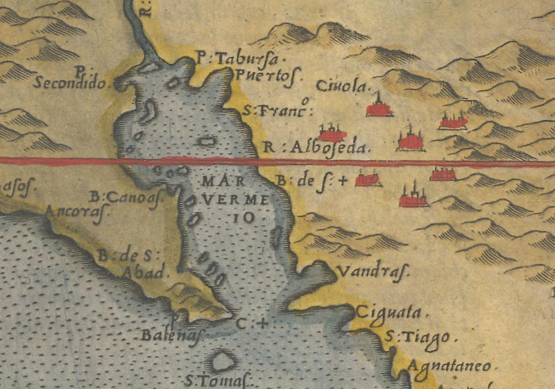
Western Place Names (16th-17th Century) The elusive seven cities of Cibola are often found in the American Southwest primarily on 16th and 17th century maps. Accounts of these legendary cities led to Francisco Coronado's ill-fated expedition in search of gold first through New Mexico and then on to the Great Plains. Place names in reference to these "golden" cities are typically either Cibola or Quivira and are often accompanied by a spurious lake.
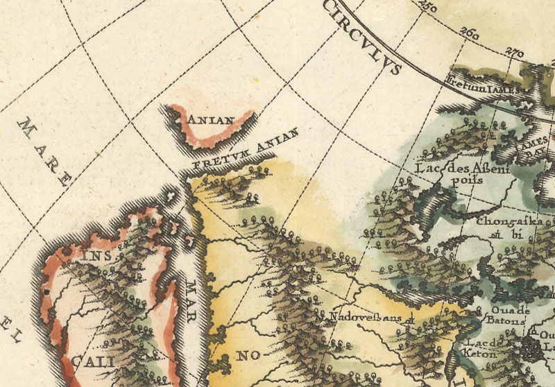
There are several other important names worth noting along the Pacific coastline. New Albion, named by Sir Francis Drake in 1579, is usually located on maps along the Northern California or Oregon coast. Drake named it for the area's resemblance to the White Cliffs at Dover, England. The Strait of Anian and Anian are also depicted on a number of 16th-18th century maps and represent a possible land or sea bridge between America and Asia. The name is likely in reference to Anan, a Chinese province reported by Marco Polo.
Depicts the legendary seven cities of Cibola. Girolamo Ruscelli, Nueva Hispania Tabula Nova, 1561.
Presents both Anian and the Strait of Anian. Heinrich Scherer, America Borealis Multis in Locis Dei Matrem Colit & Honorat, 1699.
More to Come Next month we will cover topics extending into the 19th century including western exploration, evolving political boundaries, boundary disputes, short-lived states, and more. We hope you stay tuned!
References
Burden, Philip, The Mapping of North America (Volumes I and II), Raleigh Publications, 1996-2007.
Manasek, F.J., Curt Griggs & Marti Griggs. Collecting Old Maps. Clarkdale, Arizona: Old Maps Press, 2015.
McAlhany, Joseph, The Island of California, Old World Auctions Newsletter, July 2016.
McGuirk, Donald, The Last Great Cartographic Myth - Mer de l'Ouest, MapRecord Publications, 2011.
McLaughlin, Glen, The Mapping of California as an Island: An Illustrated Checklist, The California Map Society, 1995.6.
Potter, Jonathan. Collecting Antique Maps. London: Studio Editions Limited, 1992.